Lot 525
525
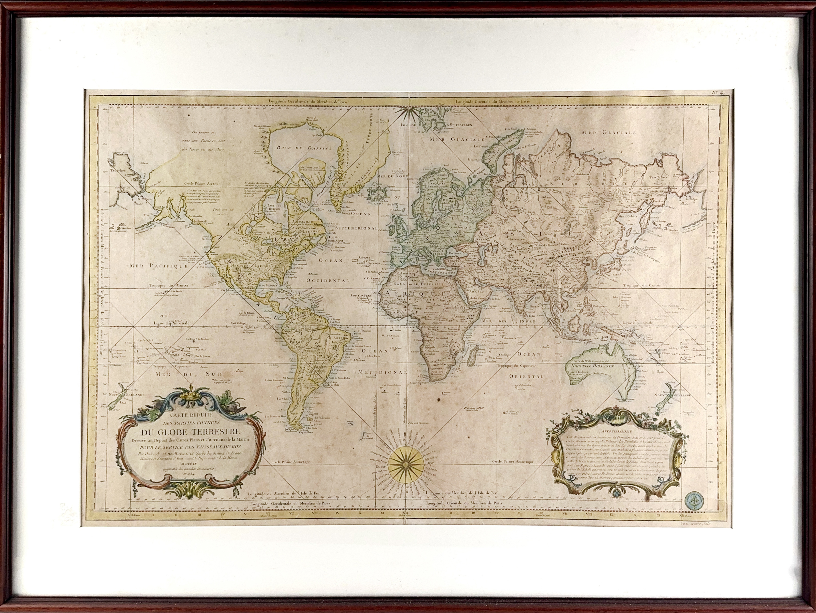
WORLD MAPS -- "CARTE REDUITE des Parties Connues du Globe Terrestre, Dressée au Dépost des Cartes Plans et Journaux de la Marine pour le Service des Vaisseaux Francais (…). Augmentée des nouvelles découvertes". (Paris), J.-N. Bellin, 1784. Engr. map, cold. by hand. 555 x 830 mm. Framed, under passepartout and glazed. (Uninspected out of frame, a bit browned).
This is an updated version of Bellin's large-scale chart of the world on Mercator's projection, which was first published in 1755.€ 300
result € 240
Back