Lot 502
502
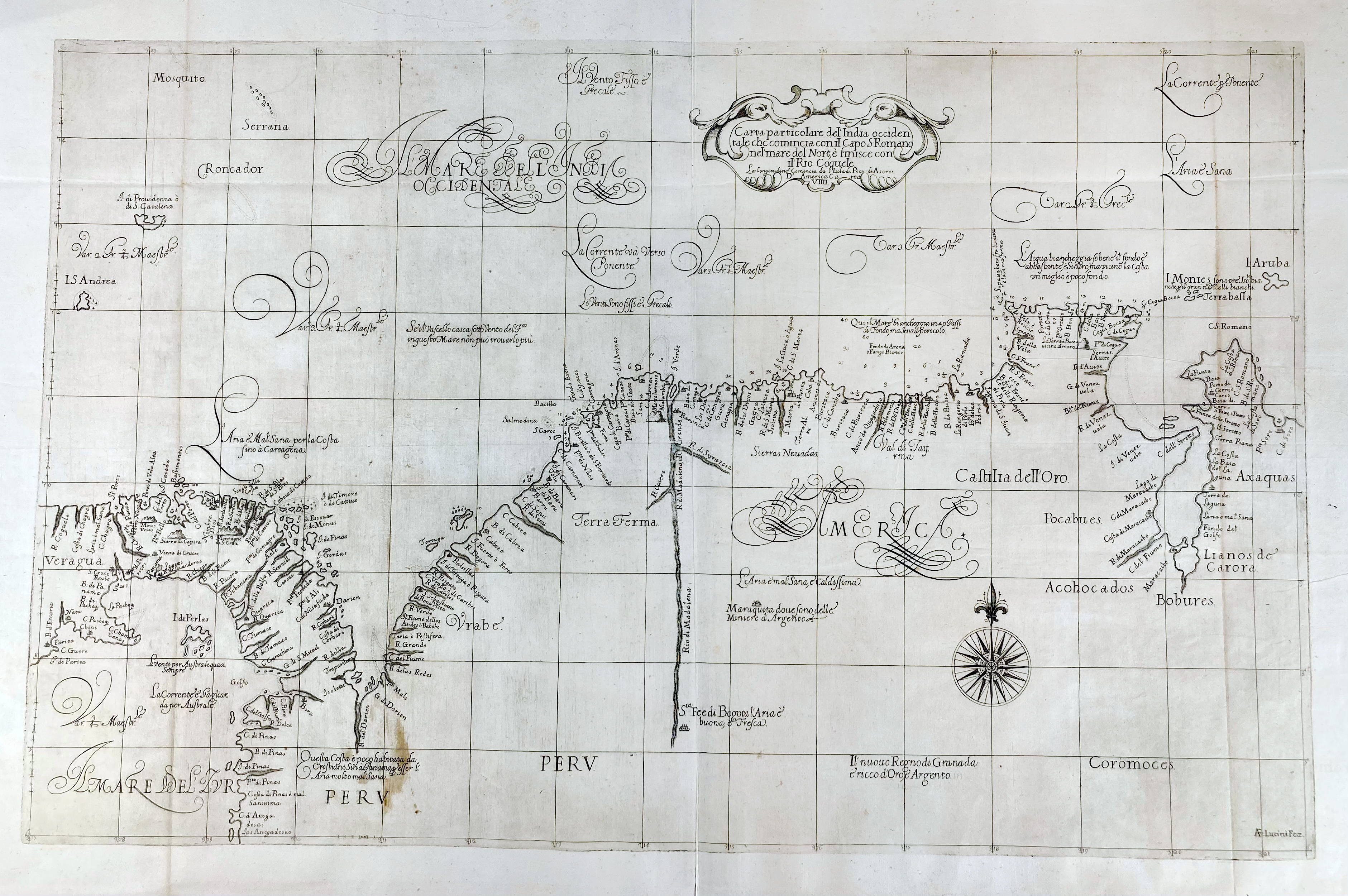
SOUTH AMERICA -- DUDLEY -- "CARTE PARTICOLARE DEL'INDIA OCCIDENTALE (…). D'America Carta VIIII". (Florence, Francesco Onofri, c. 1646-47). Engr. chart after Robert Dudley by Anton Francesco Lucini. 480 x 755 mm. (W. 3 vertical folds., small stain in lower left quadrant, but in v.g. condition).
This first state map of 'Terra Firme' was compiled and published by Robert Dudley (1574-1649) in 'Dell Arcano del Mare' (secrets of the sea), a seminal 1646-47 six-volume atlas of navigation and the first sea-atlas of the whole world. After facing personal and political difficulties in England, Dudley settled in Florence in 1605, where he entered the service of the Grand Duke of Tuscany and produced the Arcano del Mare. His charts were notable for their scientific approach, showing lines of latitude and longitude and omitting traditional rhumblines to provide accurate navigational data.€ 500
result € 1100
Back