Lot 499
499
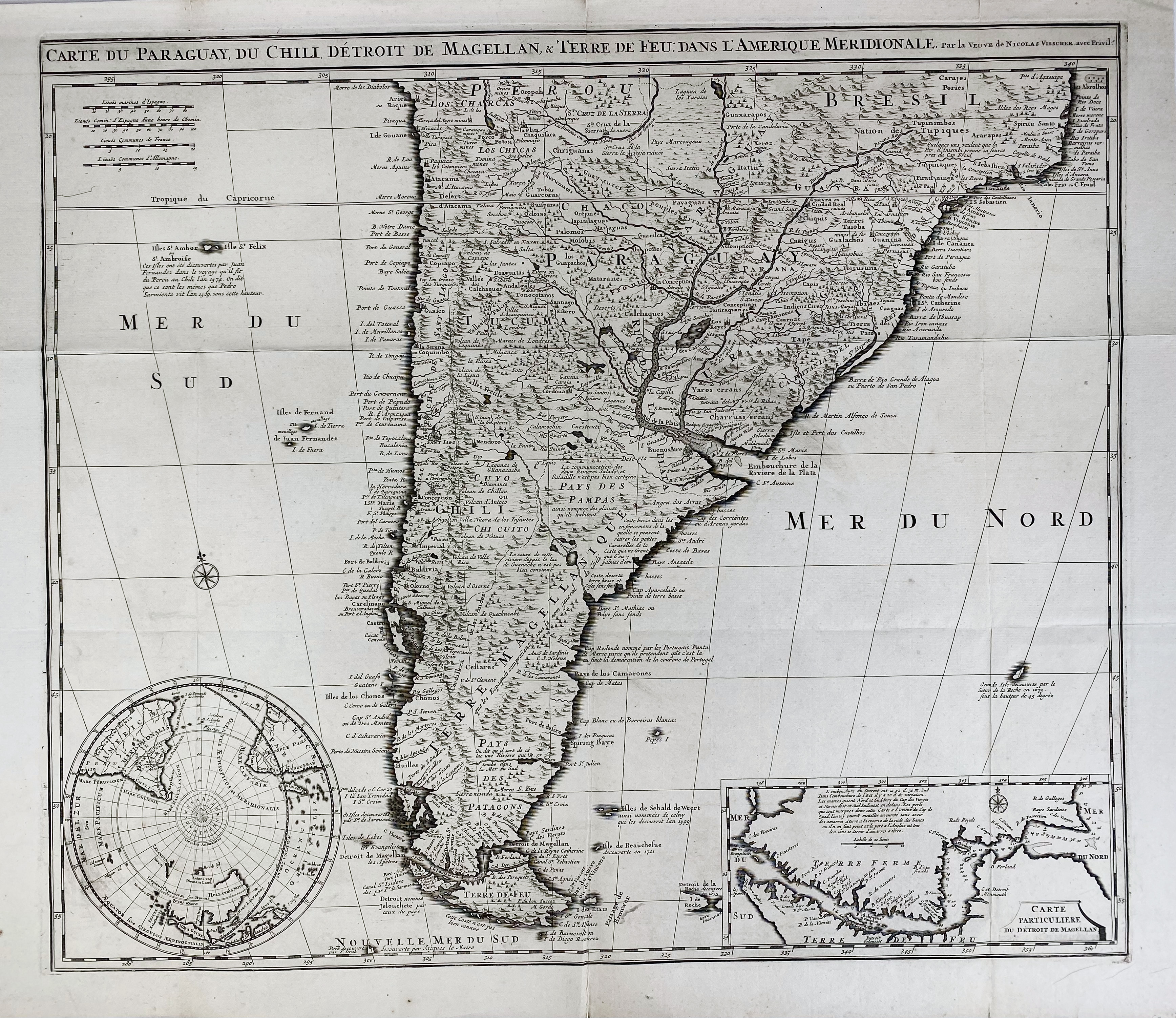
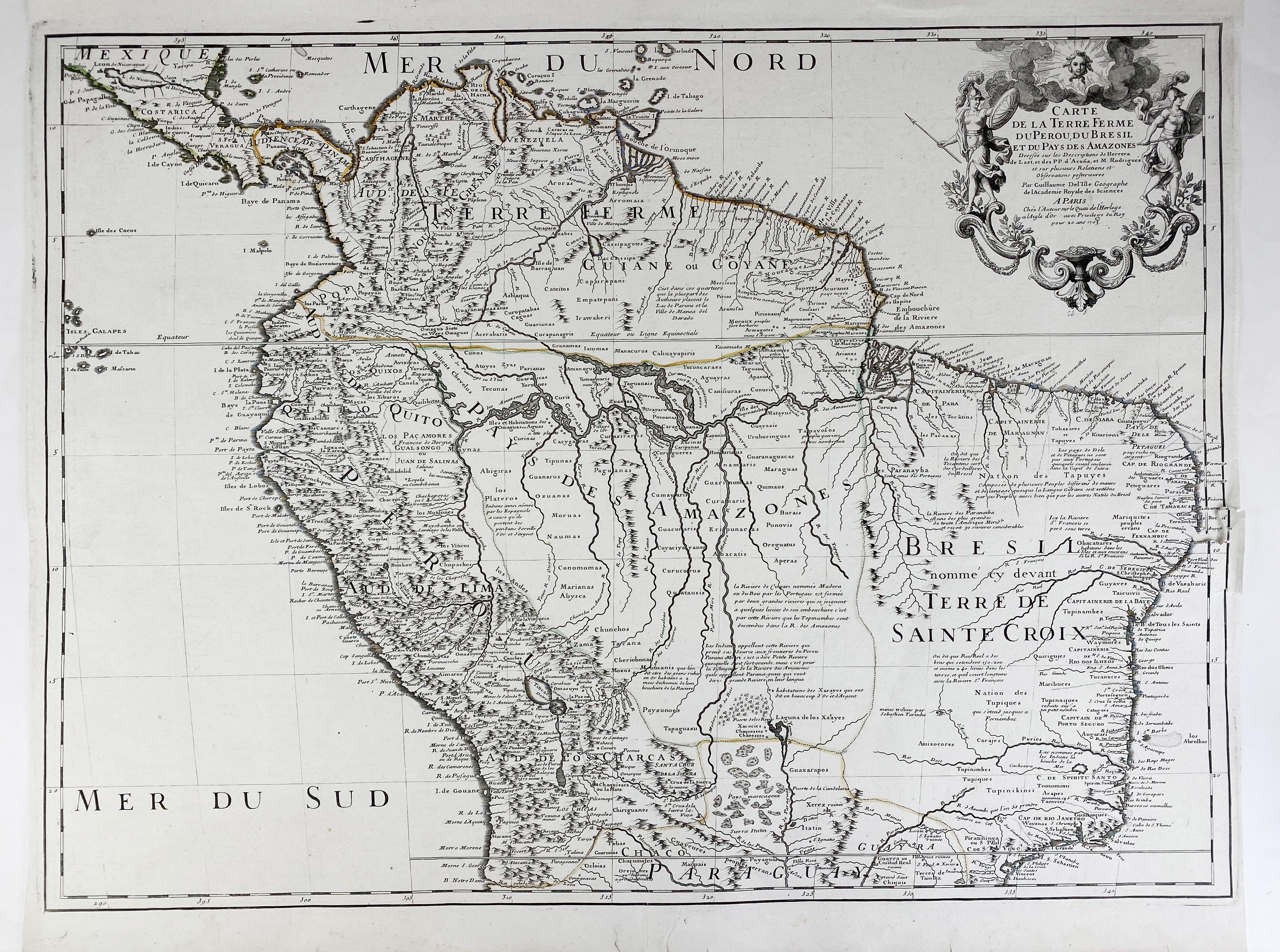
SOUTH AMERICA -- "CARTE DU PARAGAY du Chili, Détroit de Magellan, & Terre de Feu, dans l'Amerique Meridionale." Amst., Wid. N. Visscher, (c. 1710). Engr. map of the Southern part of South America. 505 x 590 mm. (A few sm. splits). -- Added: "CARTE DE LA TERRE Ferme du Perou, du Bresil, et du Pays des Amazons". Par., 1703. Engr. map, sl. cold. in outlines. 493 x 662 mm. (Some marg. tears, affecting the map in 1 place). -- "CARTE DE LA PROVINCE de Quito au Perou". (Par.), 1751. Engr. map after P.V. Maldonado. 584 x 350 mm. (Sm. tear in right margin). -- (3).
Ad 1: With 2 insets: Carte particuliere de Detroit de Magellan and Circulus Antarcticus. Includes routes of the 18th c. explorers.€ 180
result € 180
Back