Lot 492
492
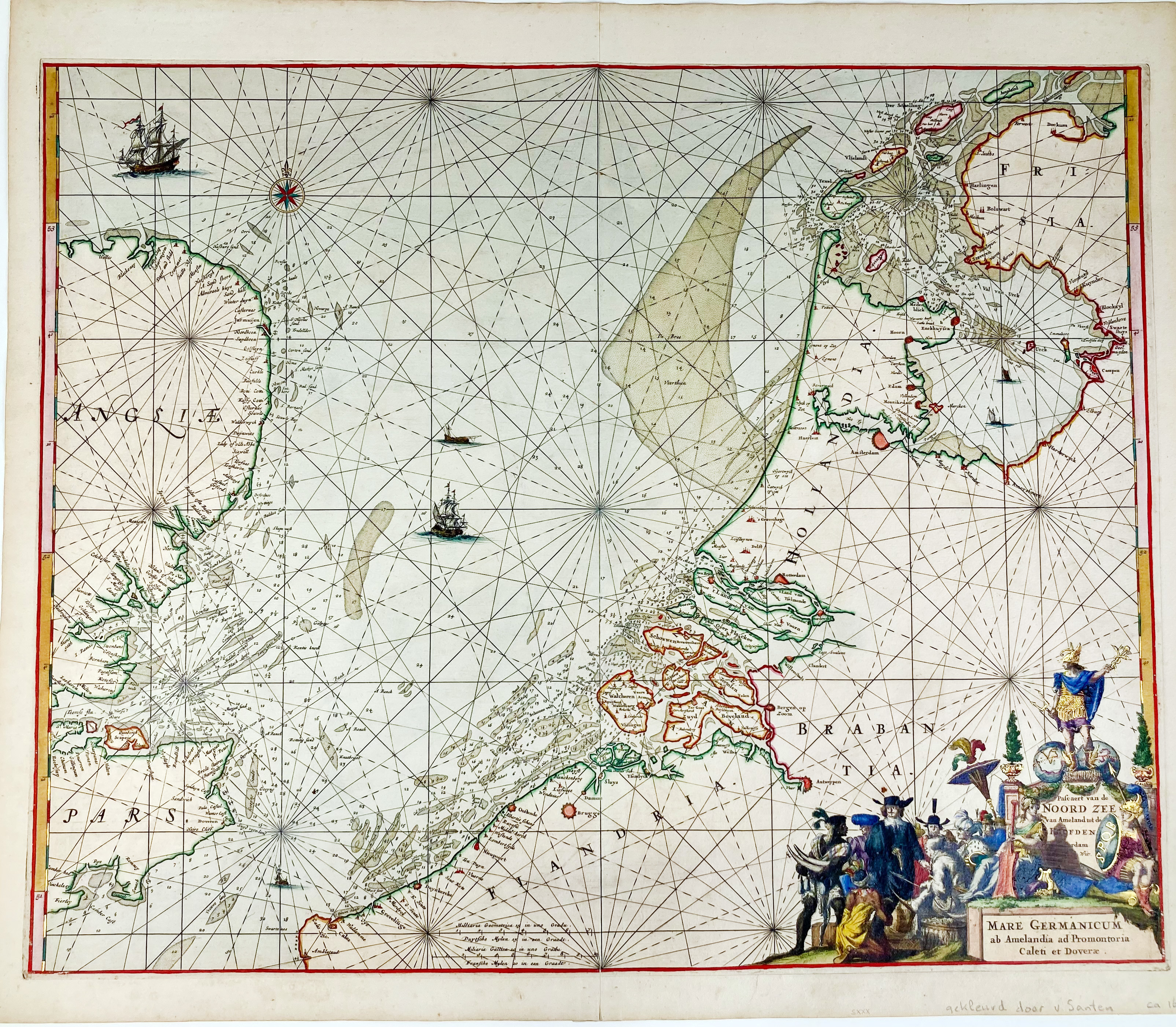
SEA CHARTS -- "PASCAERT van de Noord zee van Ameland tot de Hoofden/MARE GERMANICUM ab Amelandia ad Promontoria Caleti et Doveræ". Amst., F. de Wit, (1675). Engr. nautical chart of the coastline of Belgium, the Netherlands and a part of Great Britain, cold. by hand and gilt heightened by D.J. v. Santen, w. cold. allegorical cartouche. 480 x 595 mm.
Truusje Goedings 'Dirk Jansz. van Santen': "On maps he applied gold not only to the decorative motifs, the legends, the cartouches (…) but he also worked it decoratively into the map itself. He used gold for the dots representing cities; (…)."; Koeman IV, 518.€ 1000
result € 3000
Back