Lot 444
444
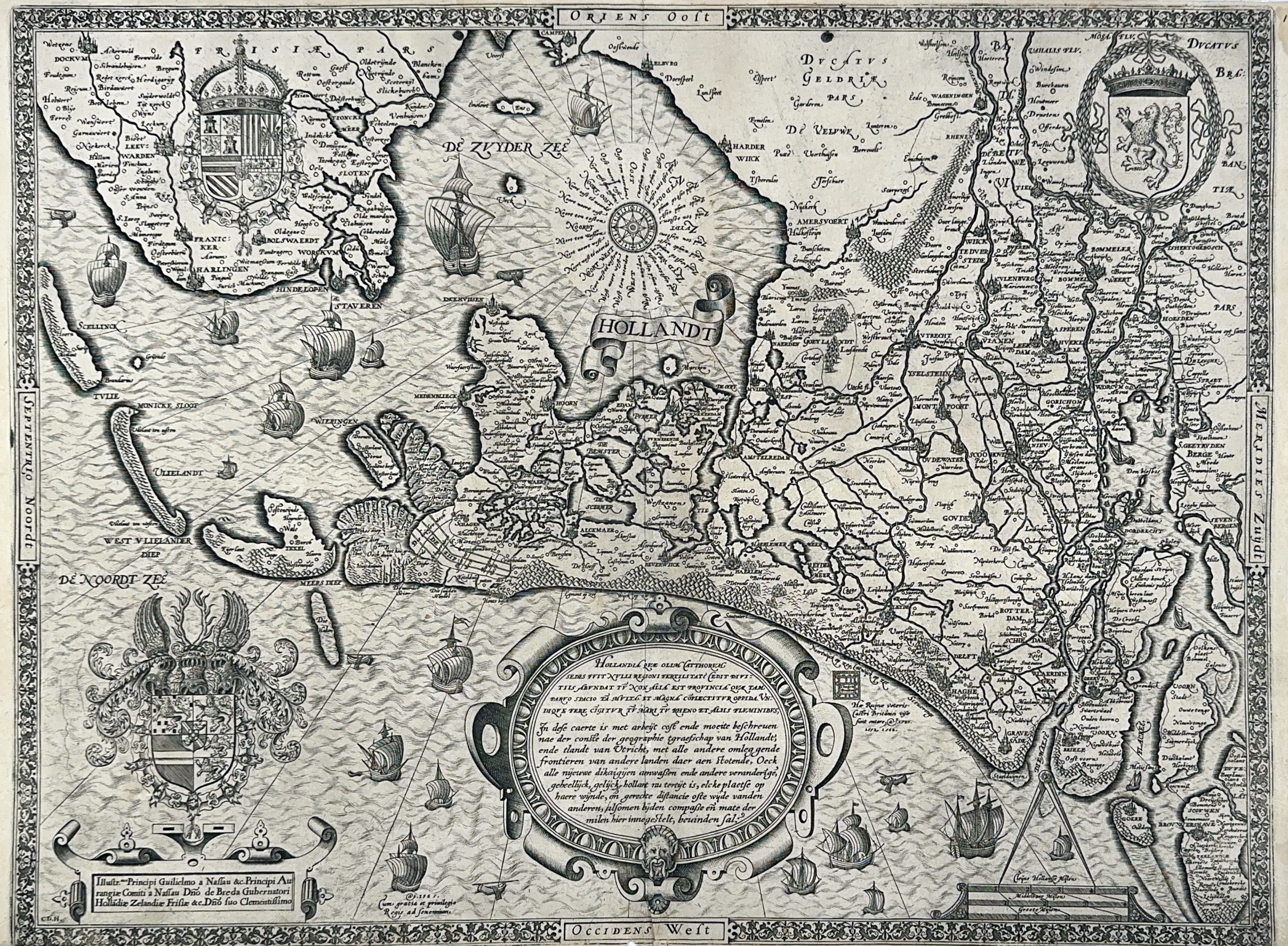
LOW COUNTRIES -- "HOLLANDT". ("Hollandia quae olim Catthorum sedes fuit (...)"). Antw., Plantijn, 1565. Engr. map probably by Cornelius de Horen, oriented east at the top, w. cartouche, 3 dec. coats of arms, many ships and dec. border, monogrammed "C.D.H." in the plate in lower left corner. 380 x 510 mm. (Margins cut short, lower margin too short and a bit frayed: affecting the decorated border, tiny hole at the bottom of central fold, a few vague stains, upper margin strengthened on v°).
Hollandia Comitatus 6, 2nd state of two. "Dit is de eerste kaart van Holland die niet op het noorden is georiënteerd. (...) Hoewel het definitieve bewijs niet te leveren is, moet bij de keus tussen [Cornelis] De Hooghe en De Horen aan de laatste voorkeur worden gegeven, aangezien vaststaat dat Cornelius de Horen een kaart van Holland heeft gemaakt en dit van Cornelis de Hooghe niet bekend is. (..) Van de eerste staat zijn enkele losse exemplaren bewaard gebleven en een exemplaar in een atlas factice." Extremely rare map. The second state differs from the first only in the heavier shading of the coastline.€ 3200
result € 4000
Back