Lot 397
397
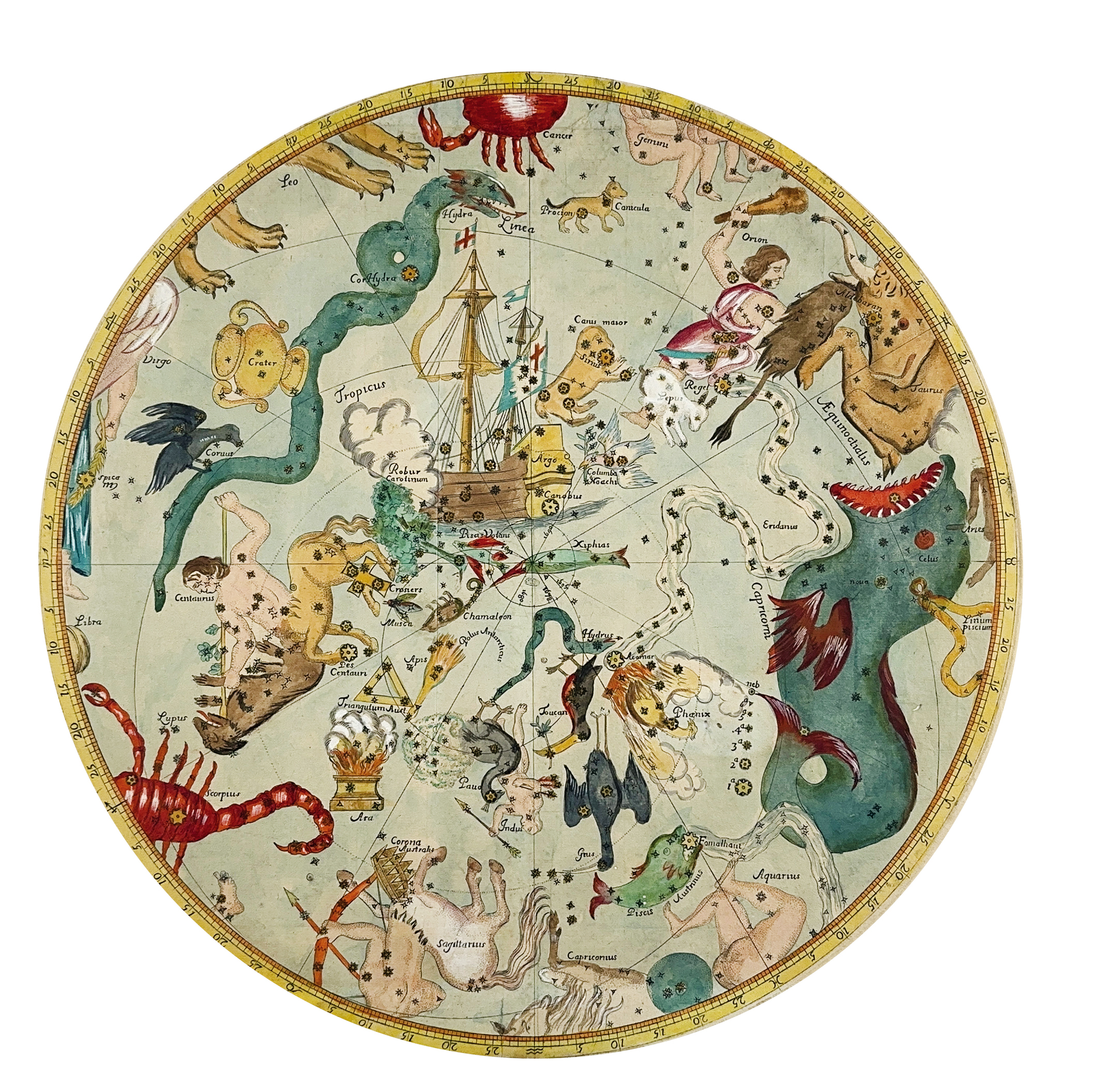
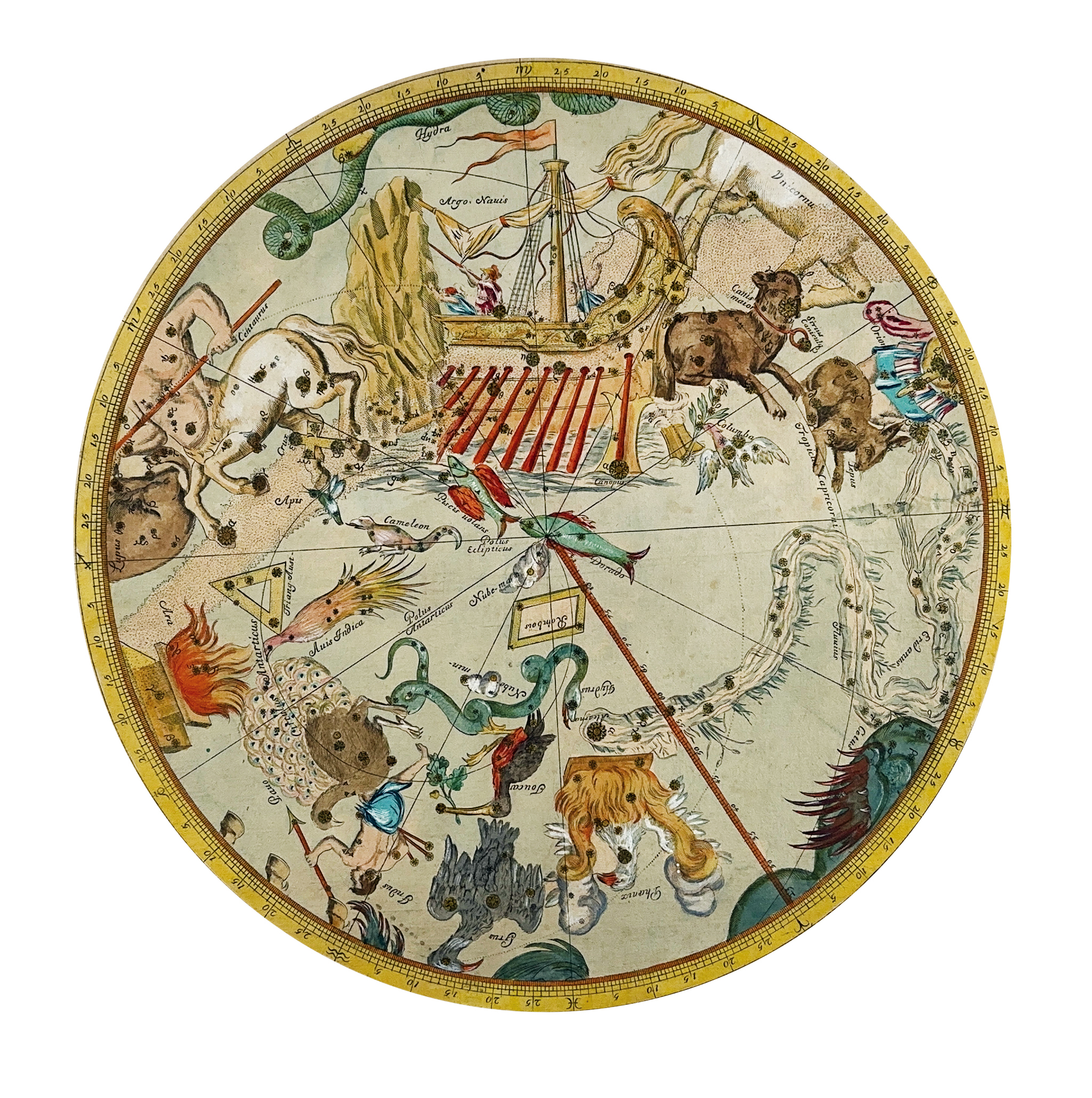
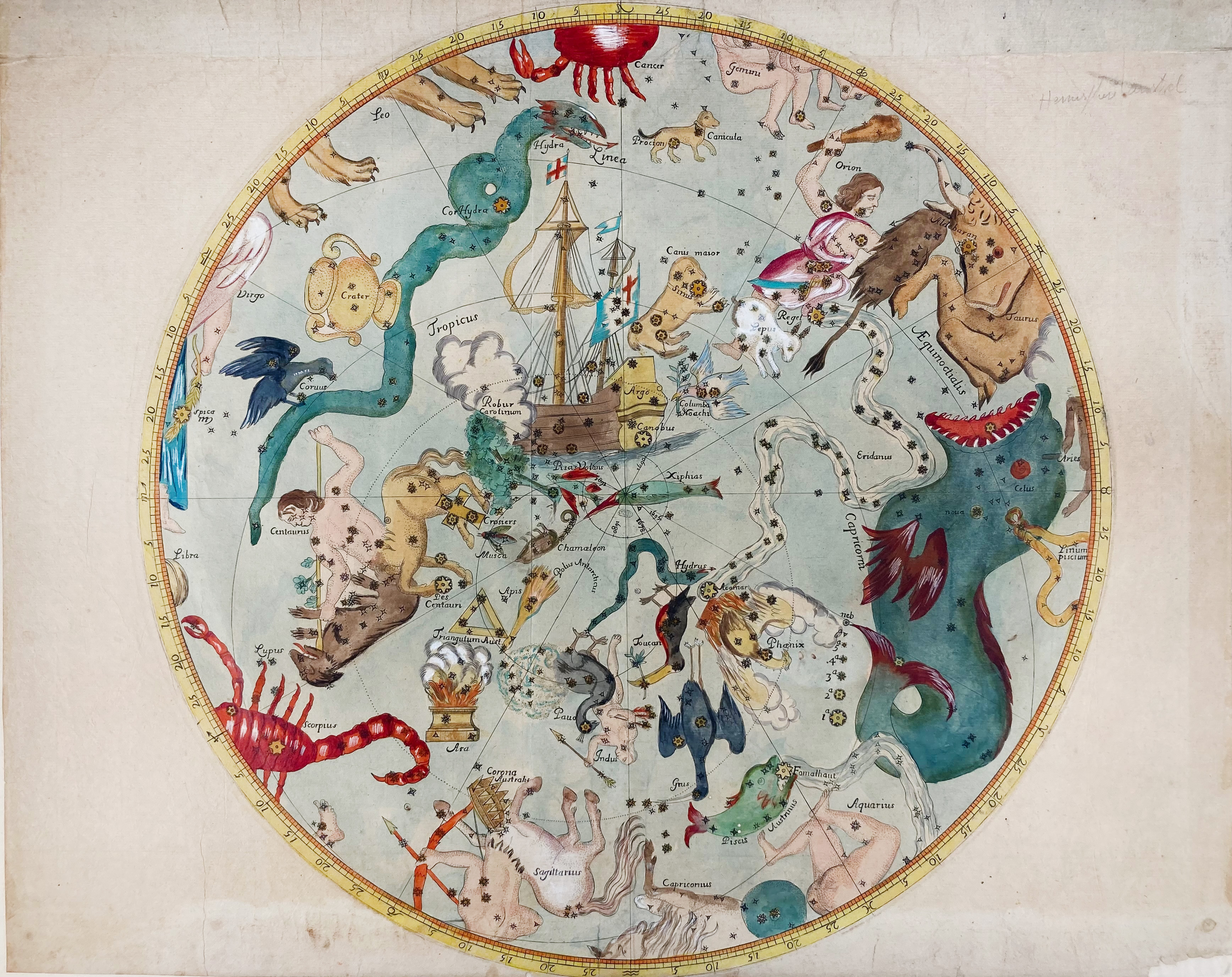
CELESTIAL CHARTS -- ROYER -- SOUTHERN CELESTIAL HEMISPHERE. (Paris, J.B. Coignard, 1679). Pair of 2 circular complementary charts printed on rectangular sheets of paper depicting the Southern celestial hemisphere, one chart more 'magnified' than the other, both cold. by hand. Ø 390 and 373 mm. (Some tiny inconspicuous holes in image in places, top and bottom margins of the largest chart short, but in good condition).
An annotation in pencil on one of the mounts suggests that these charts were made by Augustin Royer who published a celestial work 'Cartes du ciel réduites en quatre tables, contenant toutes les constellations (…)', and indeed the smallest of the charts is present in Royer's work which has 4 maps next to text. The larger chart in Royer's 'Cartes du ciel' however is not similar to the second circular chart in his work; it differs from ours, but the 'handwriting' of the names on the chart is the same. This chart is/resembles the chart in Halley's 'Catalogus stellarum' with whom Royer worked together and which is depicted in 'The History of Cartography Series, vol. IV: Cartography in the European Enlightenment'. Part 1, Ed. by M.H. Edney and M. Sponberg Pedly, 2019, p. 263. The watermark - hardly interpretable - which occurs in one of the charts seems to be French (Auvergne?), late 17th c. Maps by Royer are rarely on the market. - Royer's 'Cartes du ciel' not in Houzeau Lancaster; Macclesfield Library (Oct. 2005), lot # 1783 (only 3 charts in stead of 4).€ 2000
result € 2600
Back