Lot 393
393
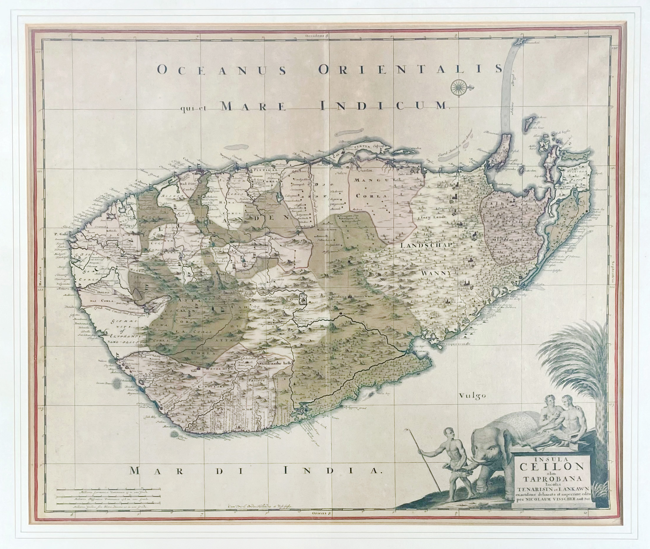
ASIA -- SRI LANKA/CEYLON -- "INSULA CEILON olim Taprobana Incolis Tenarisin et Lankawn". Amst., N. Visscher, (c. 1690). Engr. handcold. map w. large cartouche. 495 x 590 mm. Framed, glazed & under passepartout. (Significantly browned, uninspected out of frame).
Map of the governorate of Ceylon, established by the Dutch East India Company, with the Adam's Bridge ("Adams brugh") clearly depicted, linking Mannar island (Sri Lanka) to Rameswaram island (coast of India). - Koeman III, Vis [131].€ 180
result € 500
Back