Lot 386
386
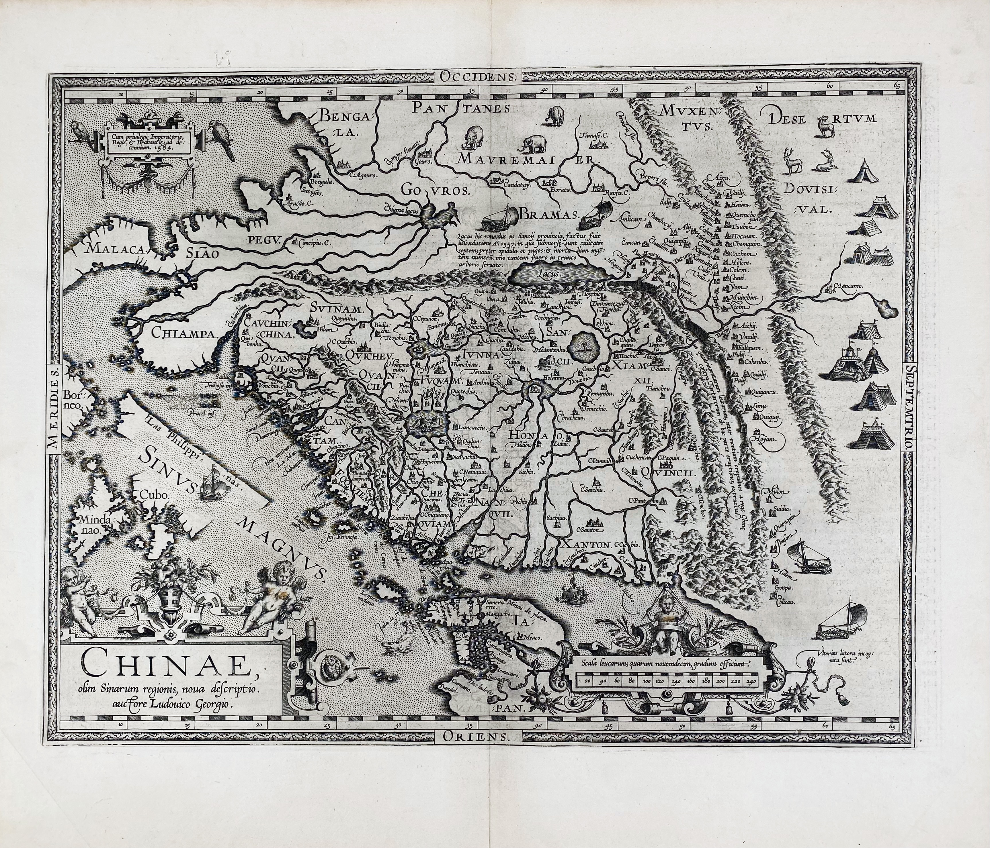
ASIA -- "CHINAE, olim Sinarum regionis, nova descriptio." (Antw., Ortelius, 1595). Engr. map w. 3 elaborate cartouches containing title, printing information and the scale bar, map decorated with animals, the Great Wall, a Tartar encampment, ships and sailing carts. 370 x 470 mm.
This is the first western map of China drawn directly from reports of the Portuguese mapmaker Luis Jorge de Barbuda (Ludovicus Georgius), who made a manuscript map of China which reached Ortelius via Arias Montanus. - Latin text on v°. Van den Broecke 164; V.d. Krogt IIIB, 8410:31 (variant b with "Las Philippinas" added).€ 1500
result € 1500
Back