Lot 493
493
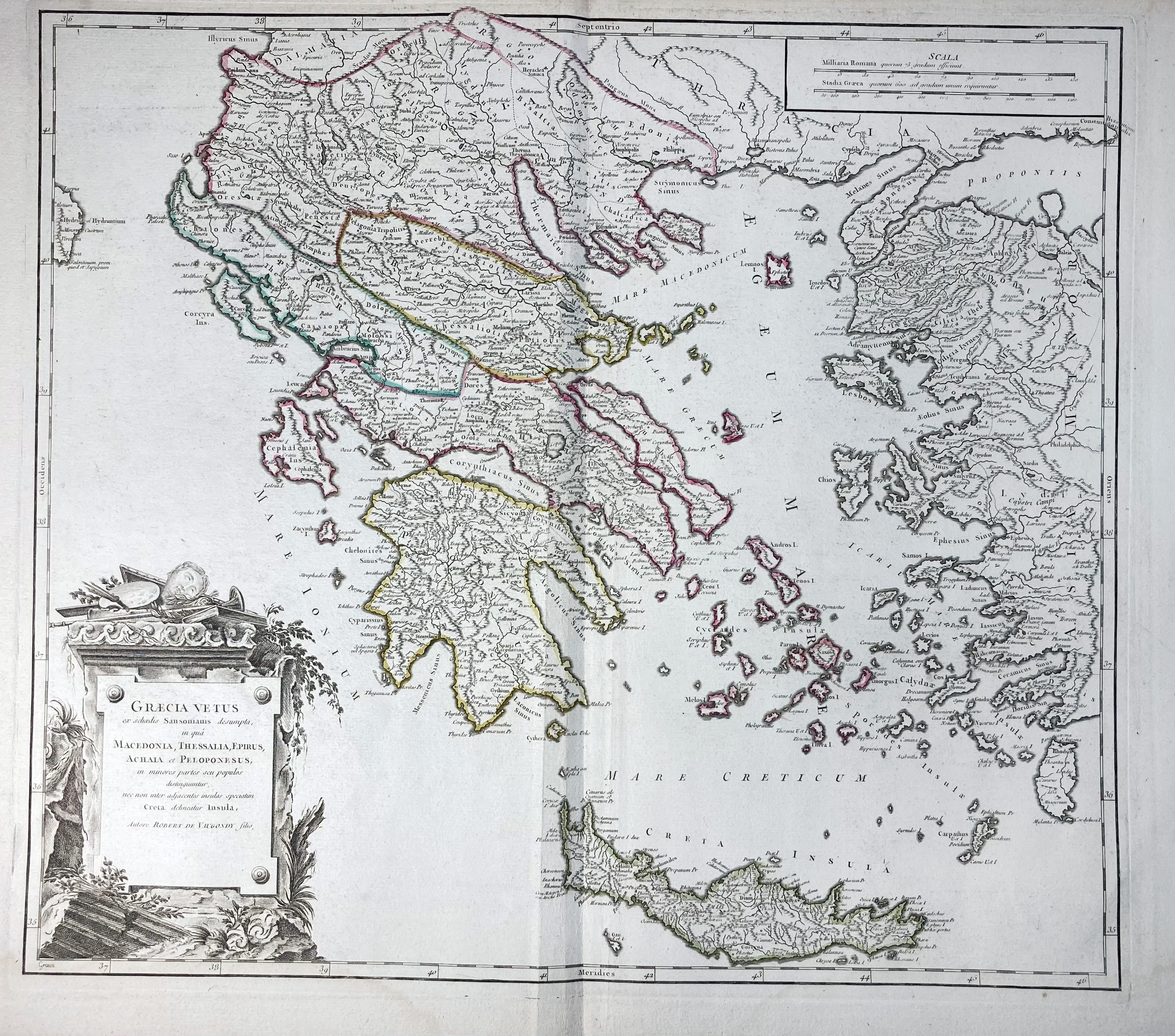
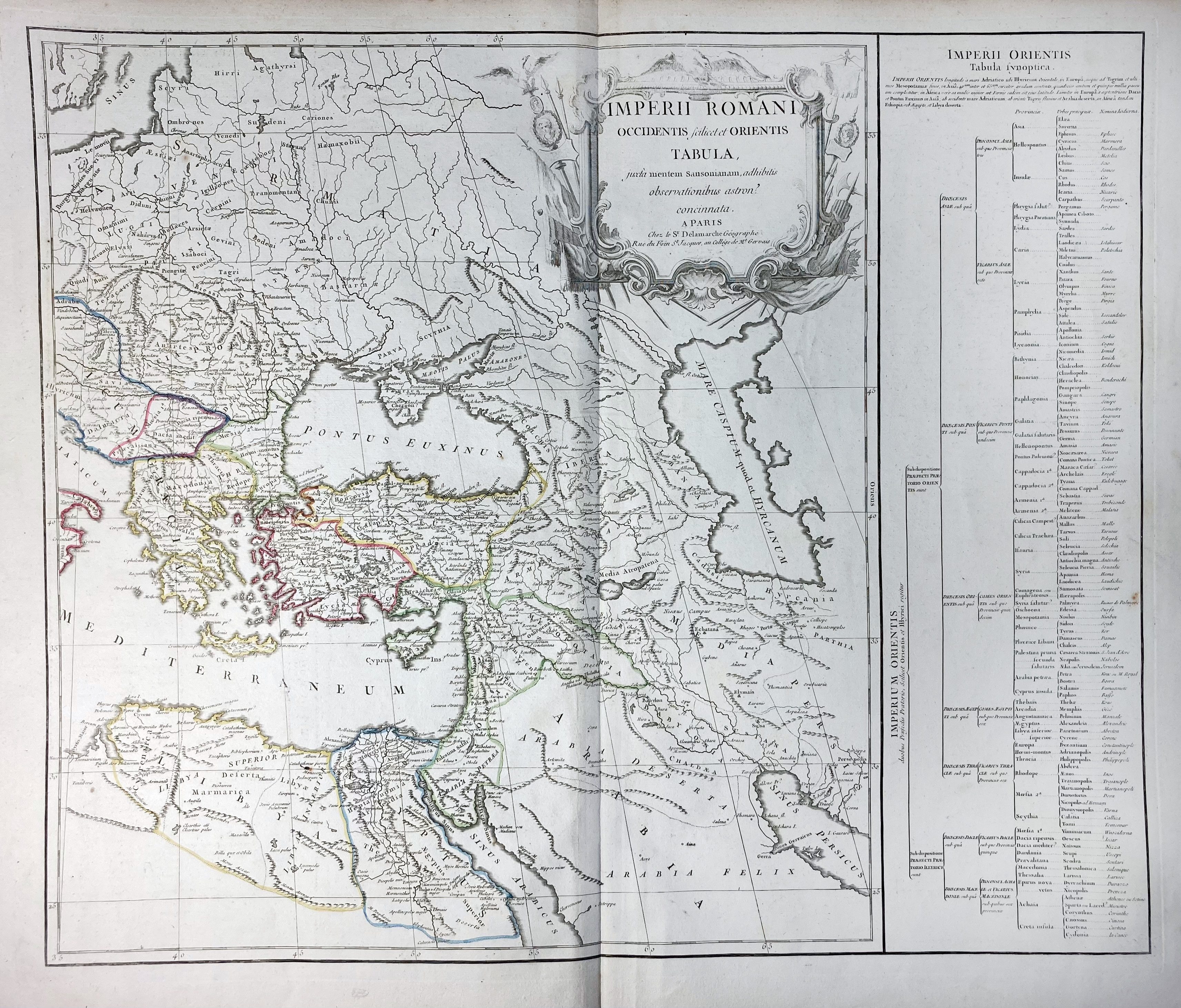
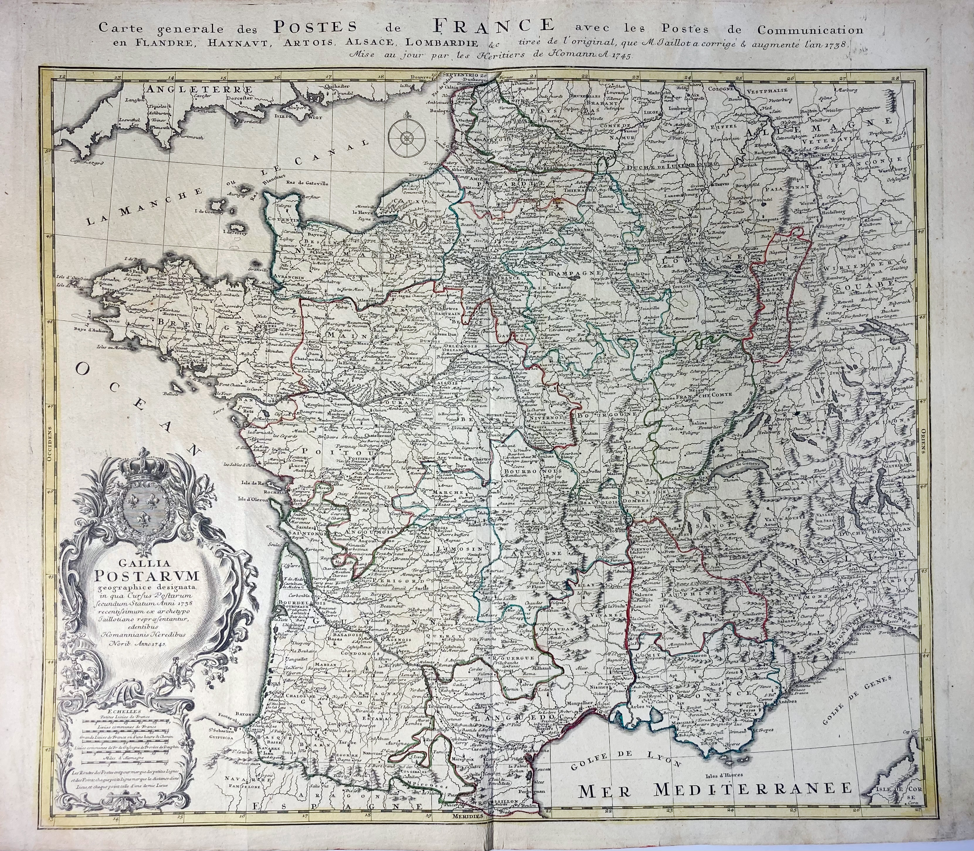
HISTORICAL MAPS -- "GRÆCIA VETUS" - "IMPERII ROMANI" - "GALLIA ANTIQUA" - "HISPANIA ANTIQUA" - "GERMANIA ANTIQUA" - "LA JUDÉE OU TERRE SAINTE" - (Paris, G. & D. Robert de Vaugondy, c. 1750). Tog. 6 engr. maps (some after Sanson), hand-cold. in outlines. c. 500 x 570 mm each. (All a bit age-toned, some splits in blank margins in places, some vertical false folds in places, but in good condition). -- Added: "CARTE GENERALE DES POSTES DE FRANCE avec les Postes de Communication (…)/GALLIA POSTARUM (…)". Nuremberg, Heirs of (J.B.) Homann, 1745. Engr. map, hand-cold. in outlines. 535 x 585 mm. -- (7).
€ 400
result € 0
Back