Lot 487
487
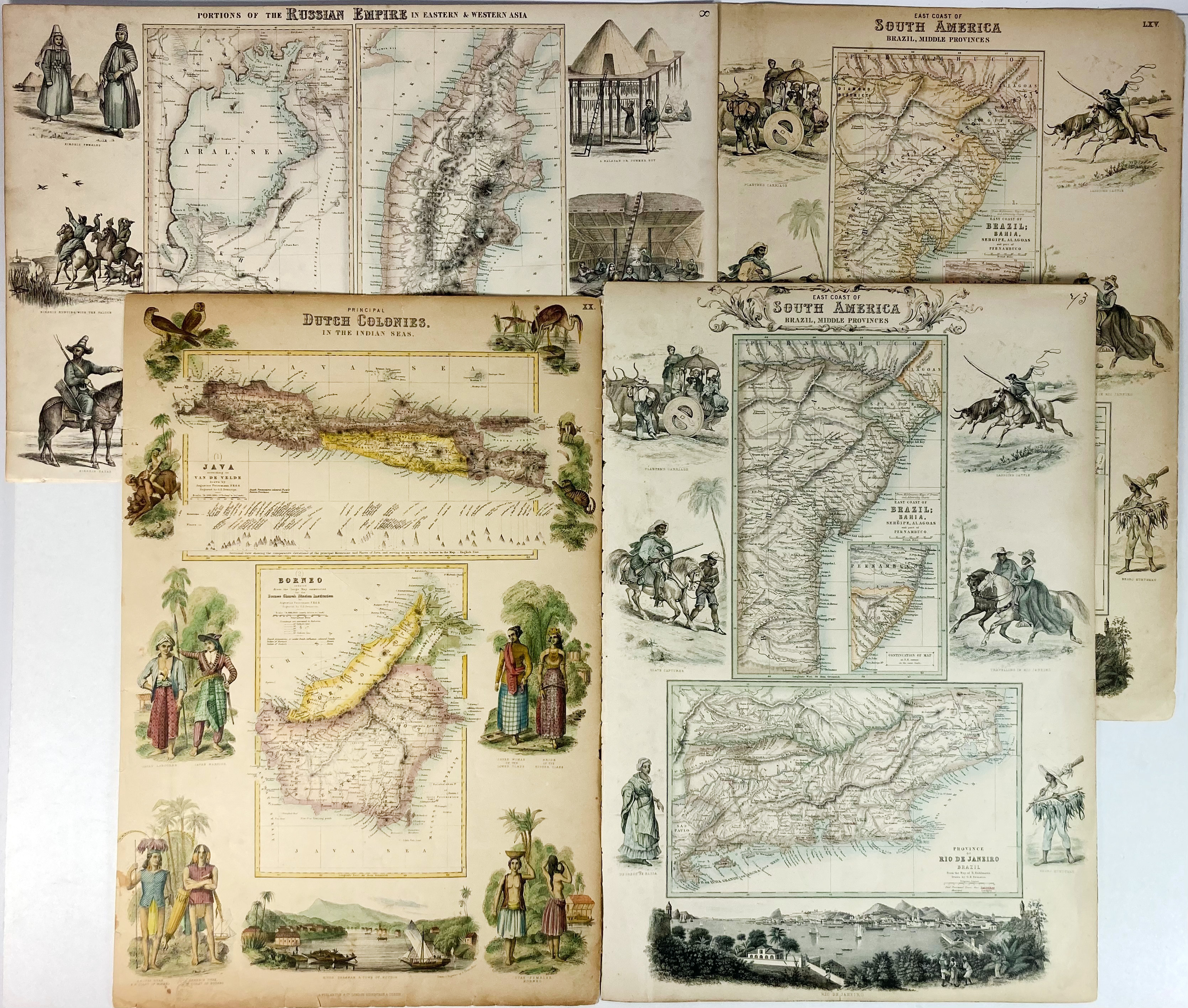
FULLARTON MAPS -- COLLECTION of 6 maps from A. Fullarton's 'Royal Illustrated Atlas Of Modern Geography', London, (etc.), 1850's. Attractively cold. lithogr. maps, 5 of which are surrounded by images of residents and a perpective view. 480 x 320 mm. (Margins a bit brittle and dam. in places and w. some small splits).
Comprising: "Portions of the Russian Empire in Eastern and Western Asia" - "Principal Dutch Colonies in the Indian Seas" - "Southern Ports and Harbours in the United States" - "West Coast of South America including Chili & part of Bolivia & Peru" - (2x) "East Coast of South America Brazil, Middle Provinces".€ 120
result € 100
Back