Lot 471
471
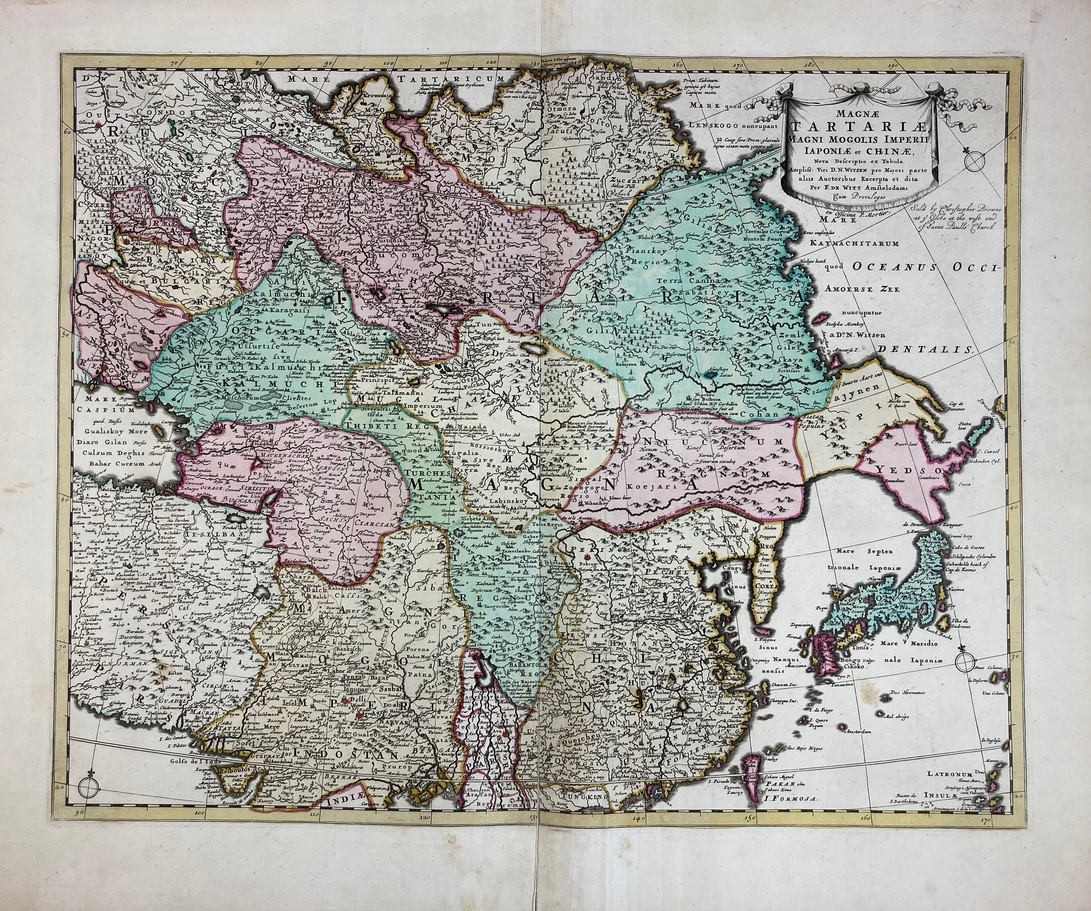
ASIA -- "MAGNÆ TARTARIÆ, Magni Mogolis Imperii Iaponiæ et Chinæ". Amst., P. Mortier, (c. 1730?). Engr. map in cont. colouring, i.a. after N. Witsen. 440 x 555 mm. On the lower right side of the title cartouche has been engraved: "Sold by Christopher Browne (etc.)". -- Added: "CARTE D'ASIE. Nouvellement revue et augmentée p. Dezauche". Paris, 1788. Engr. map cold. in outlines. 503 x 655 mm. -- "CARTE DES PAYS VOISINS de la Mer Caspiene (…)". Amst., Covens & Mortier, (c. 1730). Engr. map cold. in outlines by G. de l'Isle. 475 x 625 mm. -- "CHINA". Lond., Cadell & Davies, 1809. Engr. map cold. by hand. 570 x 510 mm. -- And 4 o. of (parts of) Asia. (8).
€ 300
result € 280
Back