Lot 986
986
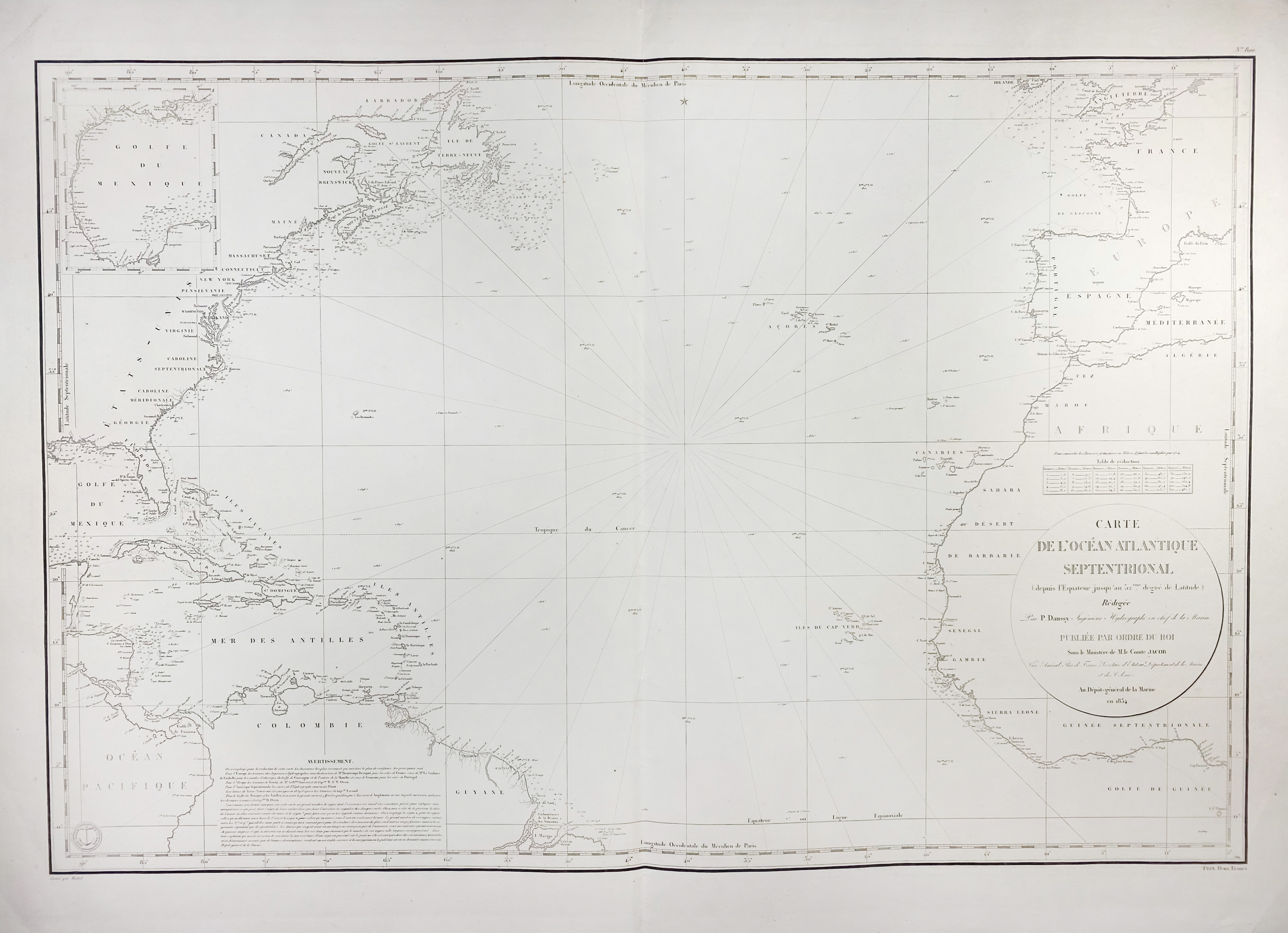
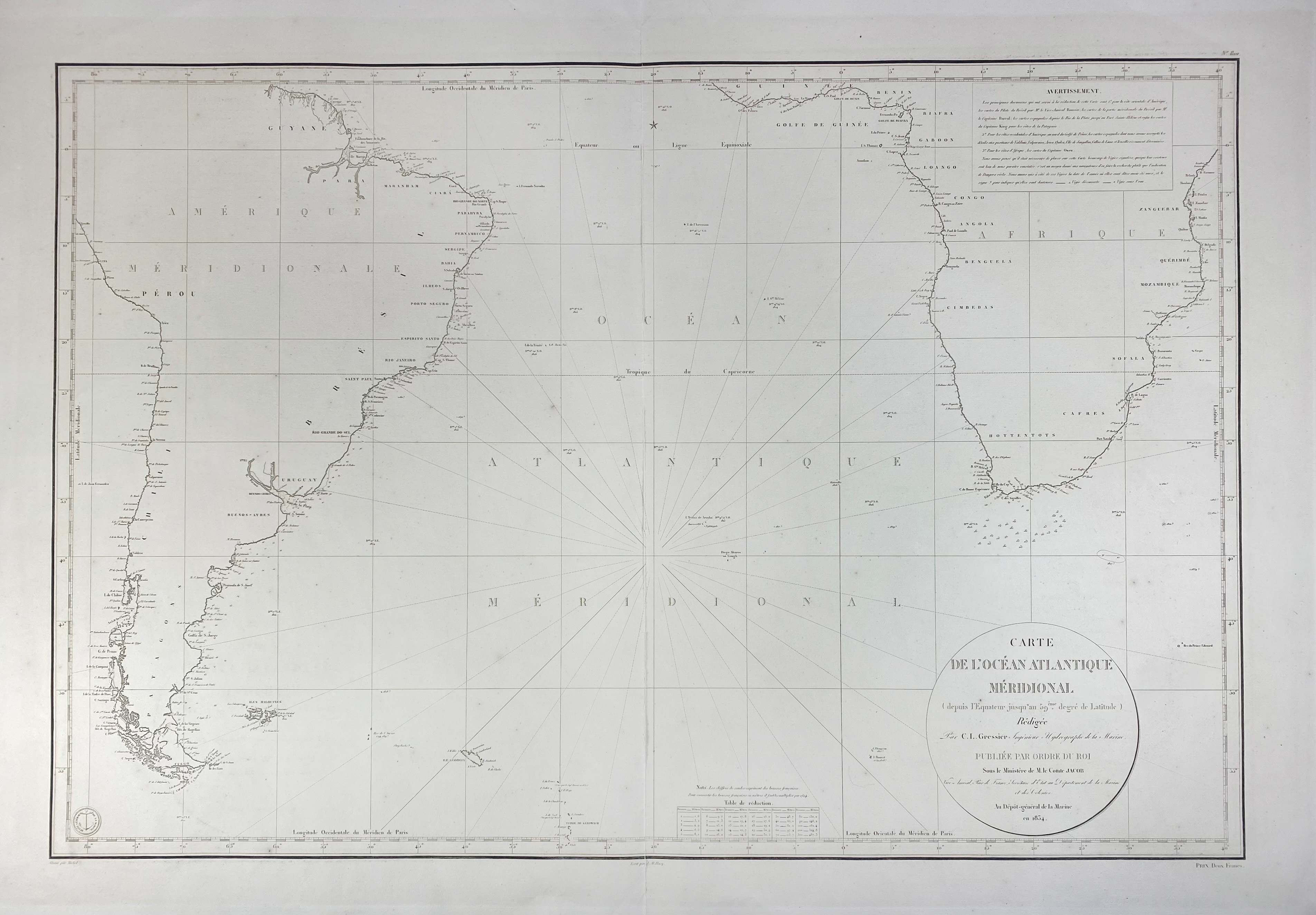
SEA CHARTS -- "CARTE DE L'OCÉAN ATLANTIQUE SEPTENTRIONAL (& MÉRIDIONAL) (depuis l'Equateur jusqu'au 52ème. degré de Latitude). Rédigée p. P. Daussy (…)". (Paris), Au Dépôt-général de la Marine, 1834. 2 plain engr. charts printed on laid paper of the North and South Atlantic. 590 x 880 mm (image size) each. (Both w. vertical fold in the centre ('Meridional' partly split), some small rep. to margins on v°).
€ 150
result € 0
Back