Lot 1001
1001
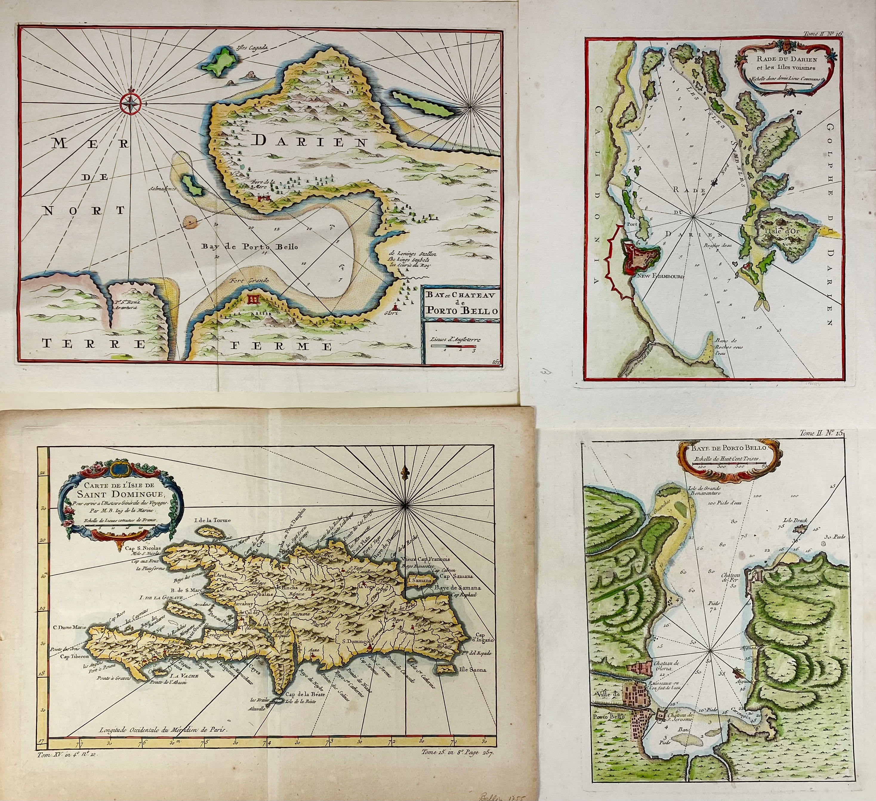
SOUTH AMERICA -- CARIBBEAN -- "RADE DU DARIEN et les Isles voisines". (Par., 1764). Handcold. engr. map by J.N. Bellin. 230 x 175 mm. -- "CARTE DE L'ISLE DE SAINT DOMINGUE". (Par., 1764). Handcold. engr. map by J.N. Bellin. 216 x 310 mm. -- "BAY ET CHATEAU de Porto Bello". (Par., 1764). Handcold. engr. map by J.N. Bellin. 220 x 315 mm. -- "BAYE DE PORTO BELLO". (Par., 1764). Handcold. engr. map by J.N. Bellin. 225 X 180 mm. -- And 2 o. (6).
€ 180
result € 0
Back