Lot 505
505
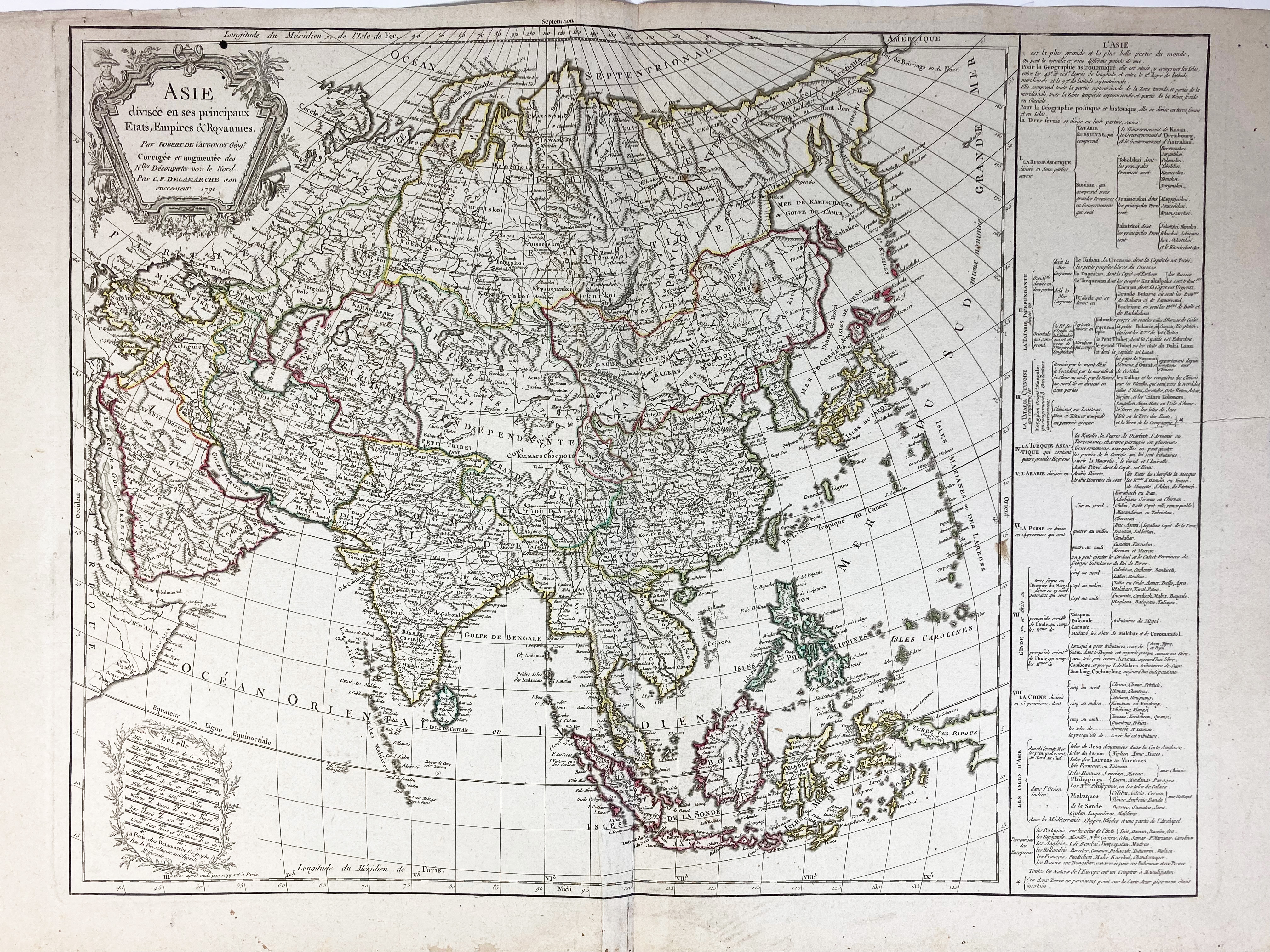
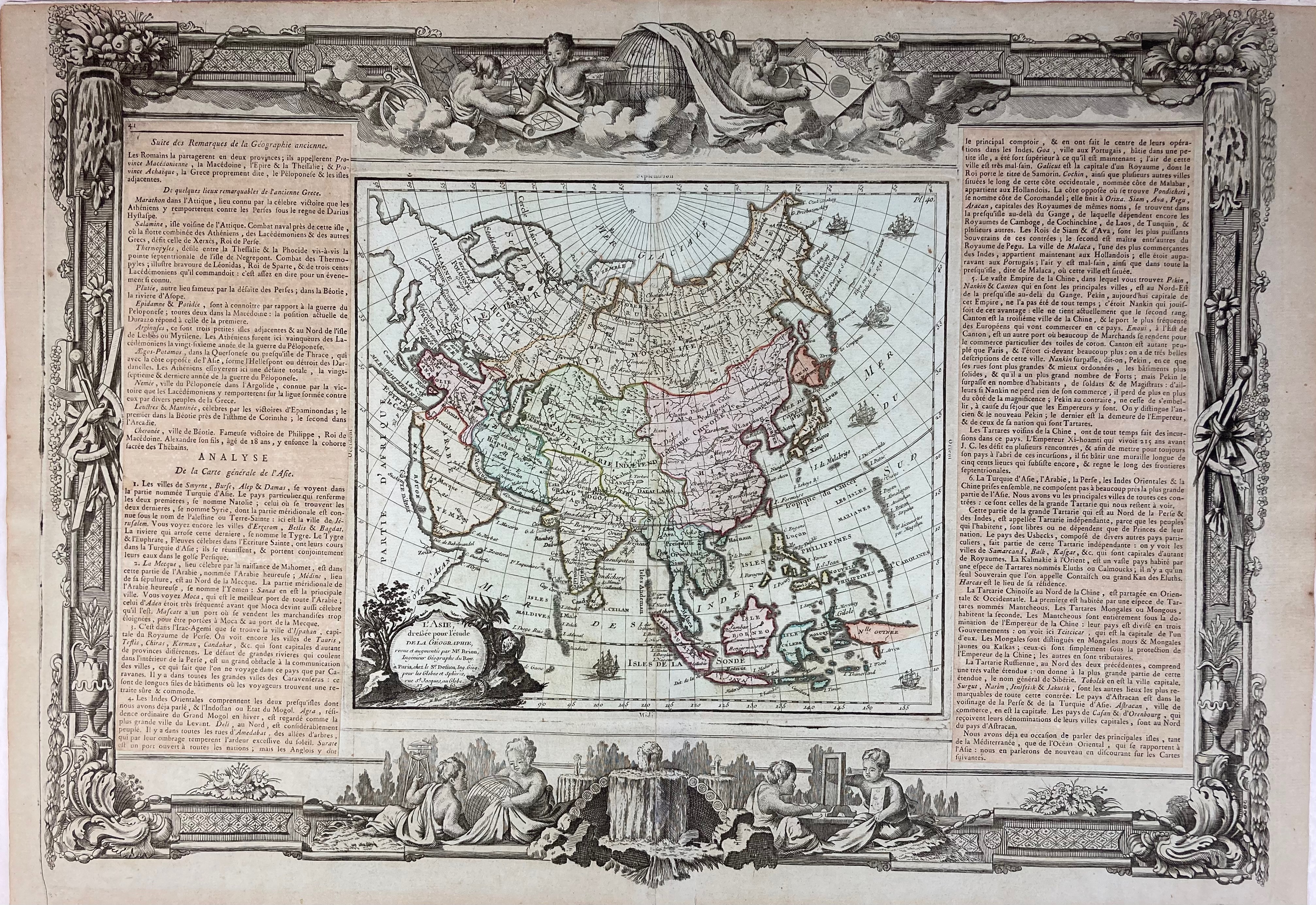
ASIA -- "ASIE divisée en ses principaux Etats, Empires & Royaumes par Robert de Vaugondy (…) Corrigée et augmentée (æ) par C.F. Delamarche". (Paris), 1791. Engr. map cold. in outlines. 507 x 678 mm. -- Added: "L'ASIE dreßée pour l'étude de la Géographie, revue et augmentée par Mr. Brion". Paris, Desnos, n.d. (1771). Cold. engr. map surrounded by highly decorative border and 2 columns of explan. text. 235 x 265 mm (map size). -- (2).
€ 160
result € 200
Back