Lot 607
607
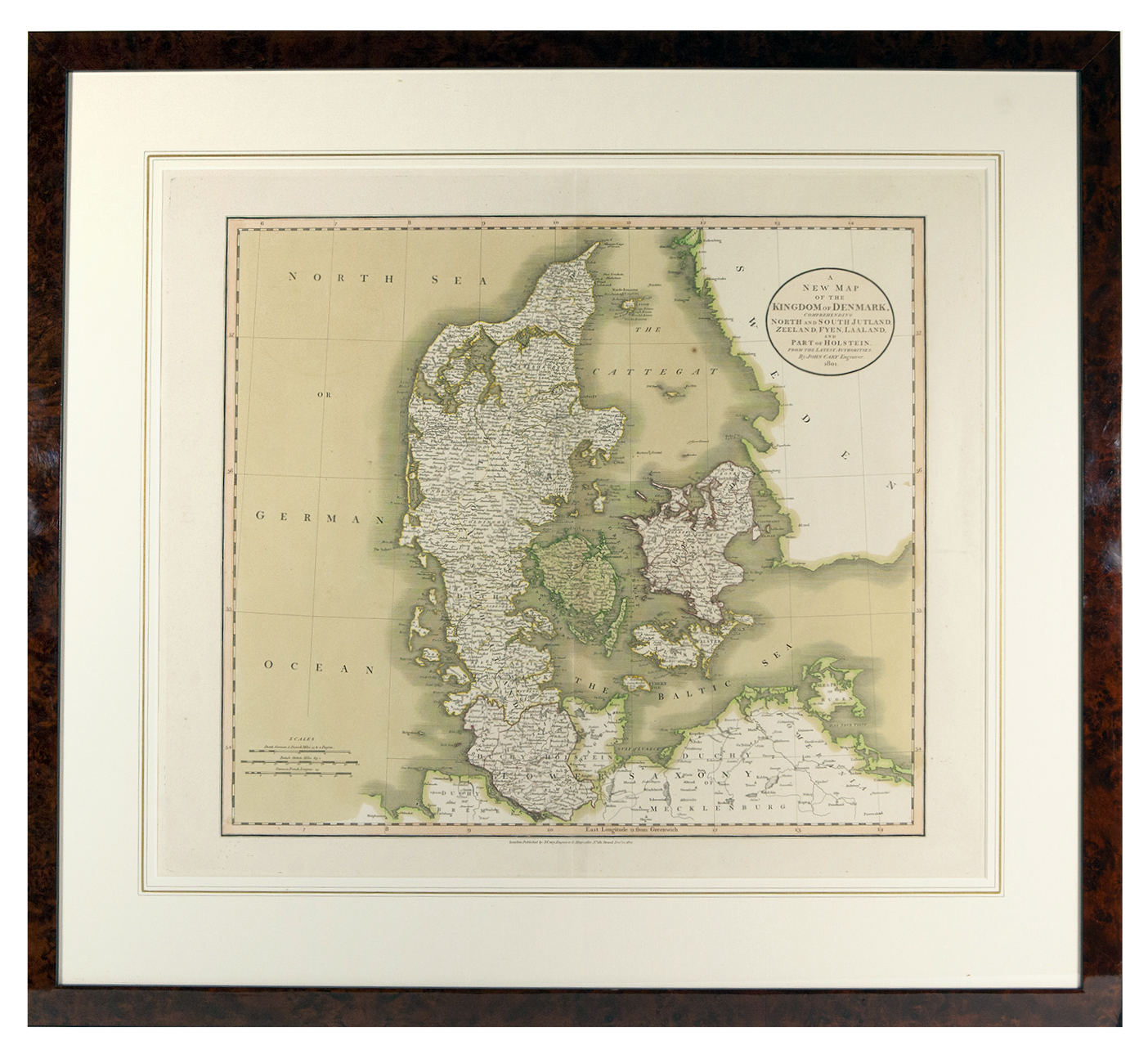
DENMARK -- "A NEW MAP OF THE KINGDOM OF DENMARK, Comprehending North and South Jutland, Zeeland, Fyen, Laaland and part of Holstein". London, J. Cary, 1801. Engr. map, cold. by hand. 515 x 600 mm. Framed, glazed and under passepartout. - In very good condition.
€ 100
result € 80
Back