Lot 345
345
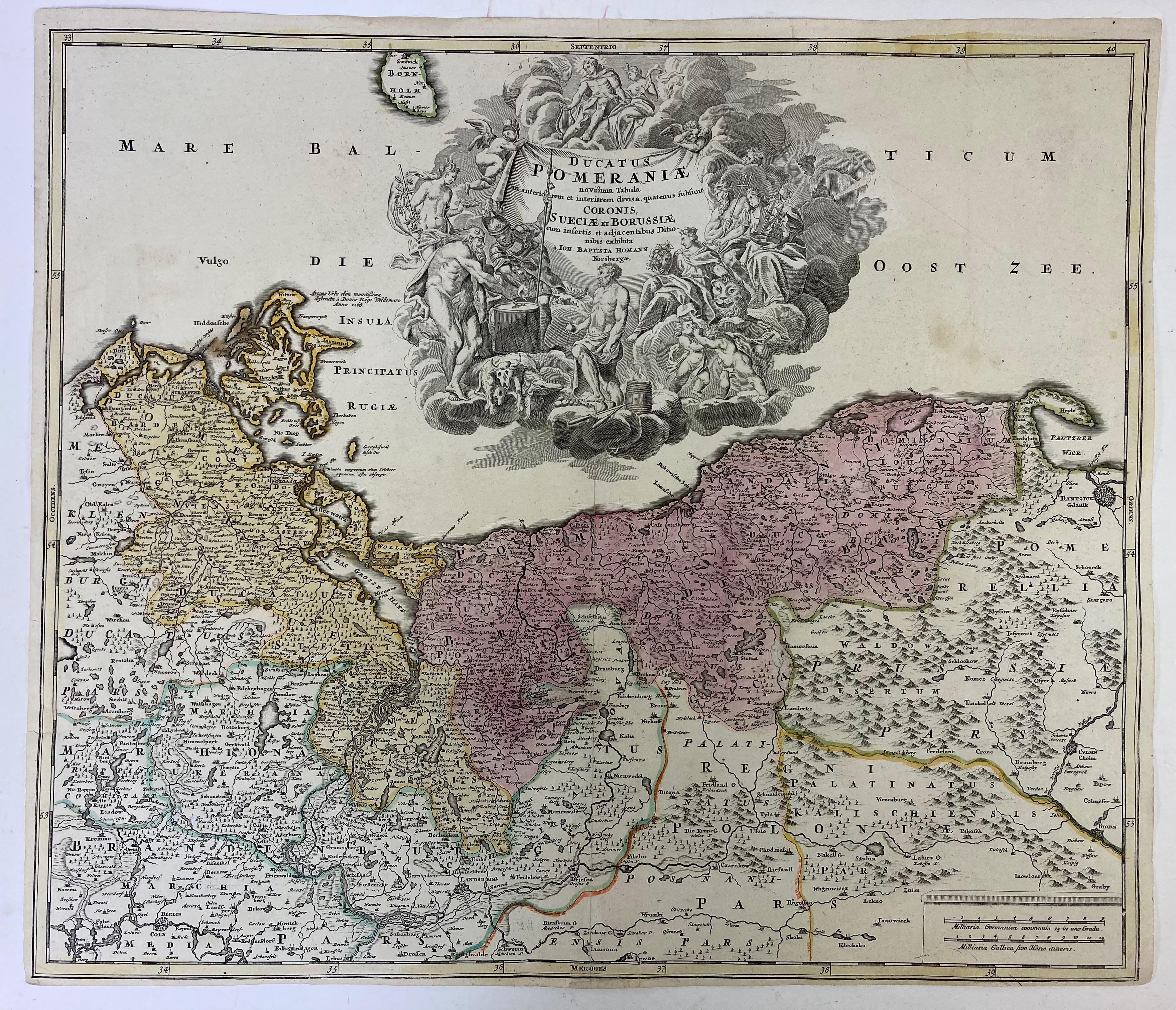
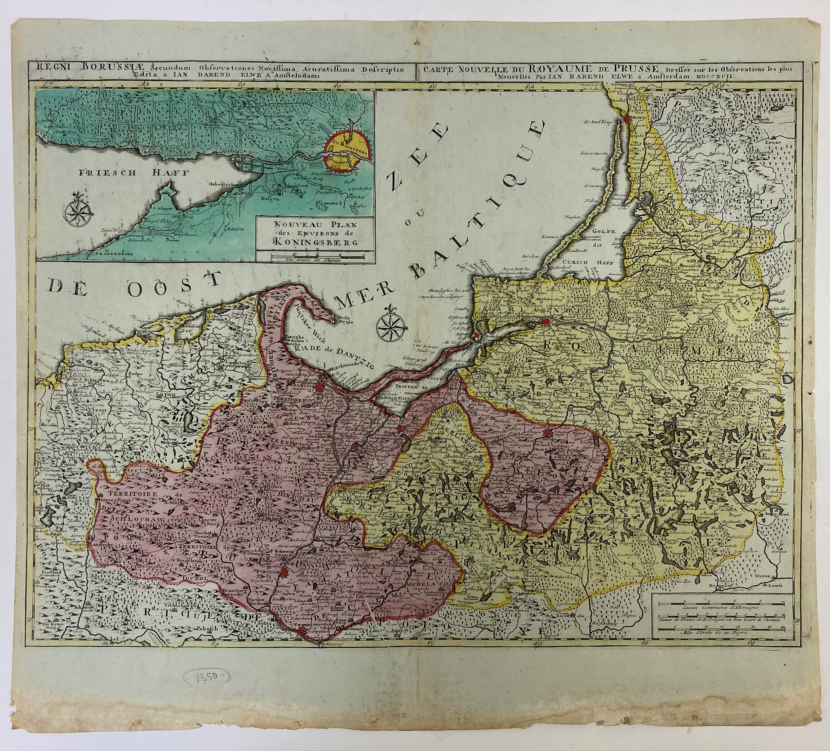
BALTIC SEA -- "DUCATUS POMERANIÆ novissima Tabula (…)". Nuremberg, J.B. Homann, n.d. (c. 1720). Engr. map of the Baltic coast between Stralsund and Danzig, in cont. col. 500 x 575 mm. -- Added: "REGNI BORUSSIÆ (…)/CARTE NOUVELLE de Royaume de Prusse (…)". Amst., J.B. Elwe, 1792. Engr. map of the Baltic coast between Schlawa and Memel w. inset plan of Koningsberg and surroundings in cont. col. 465 x 622 mm. (Lower blank margin stained). -- (2).
€ 200
result € 170
Back