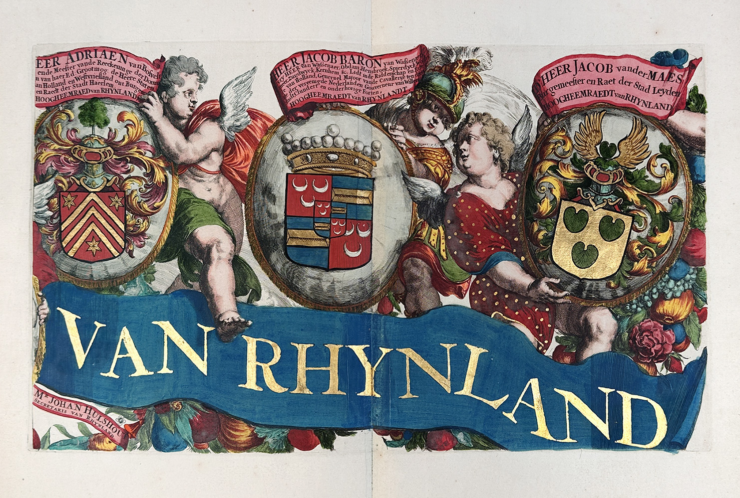
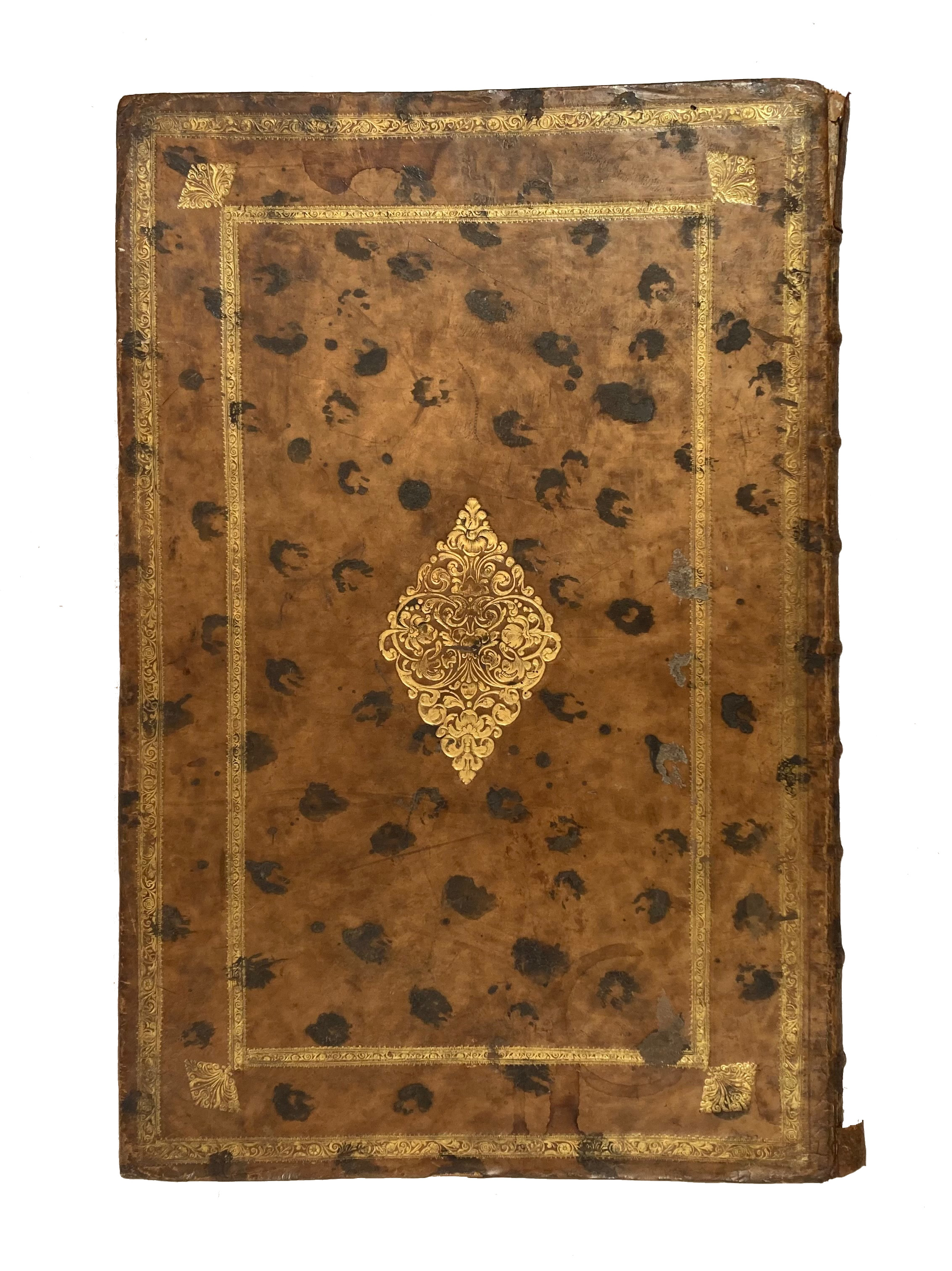
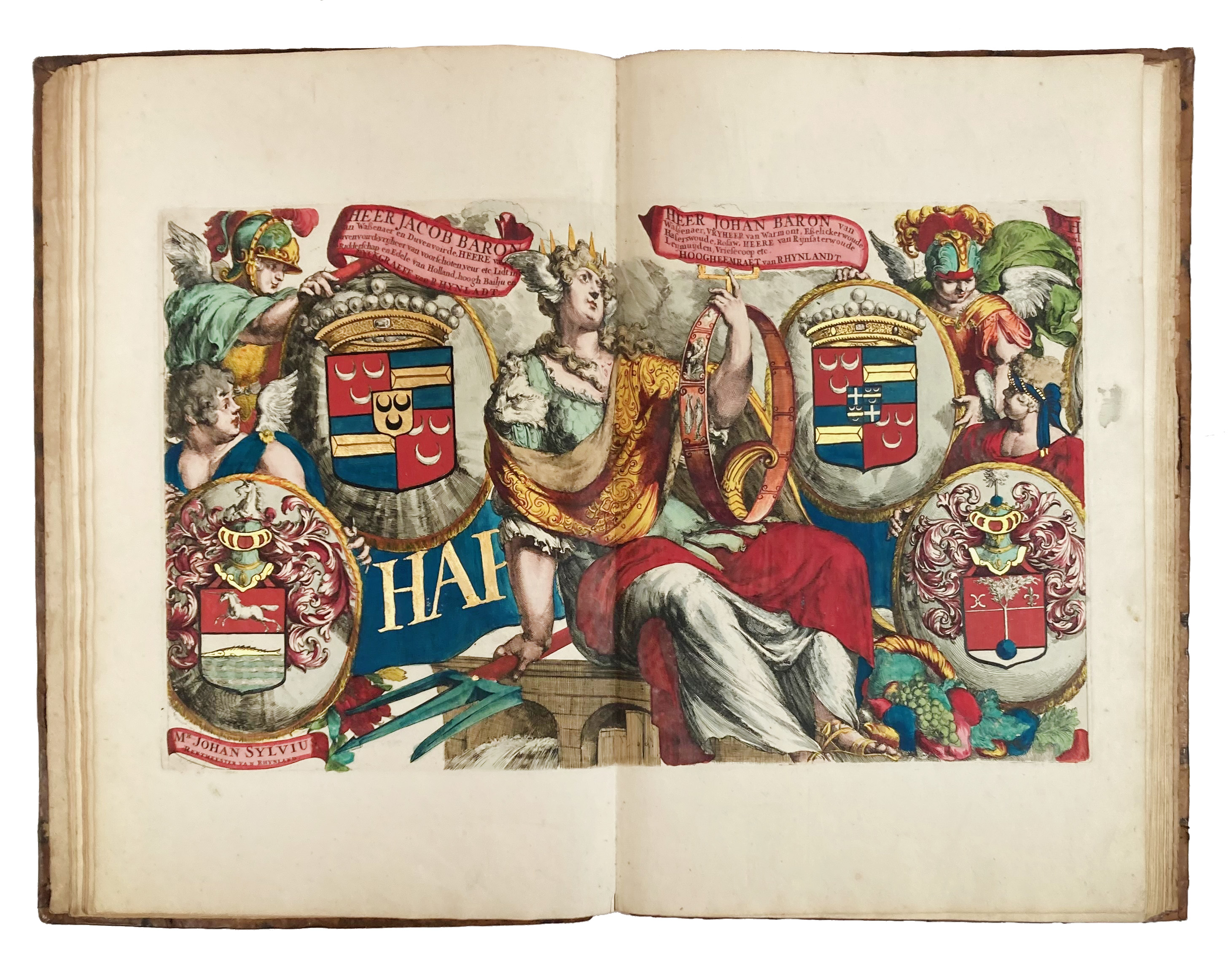
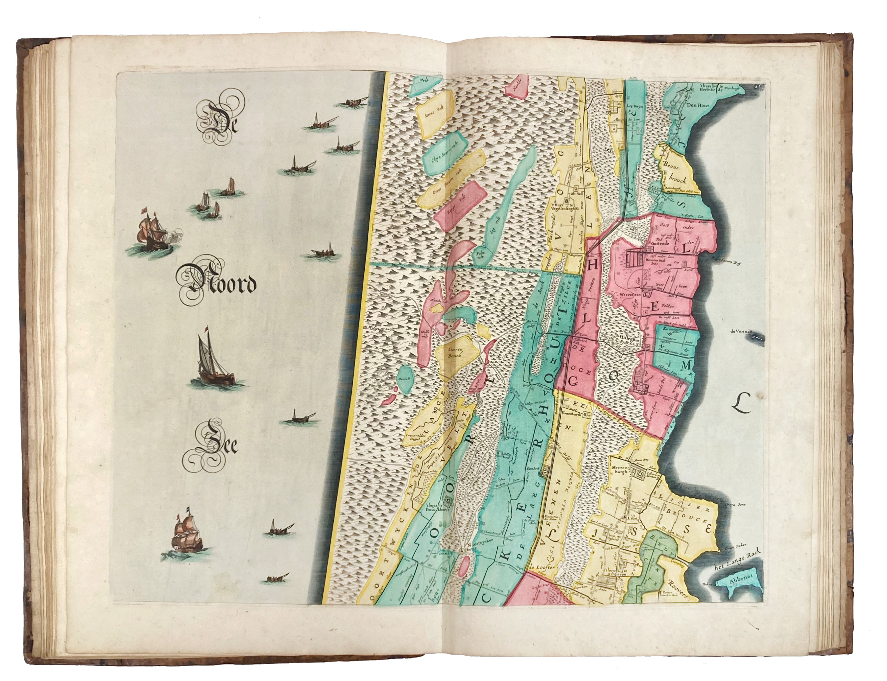
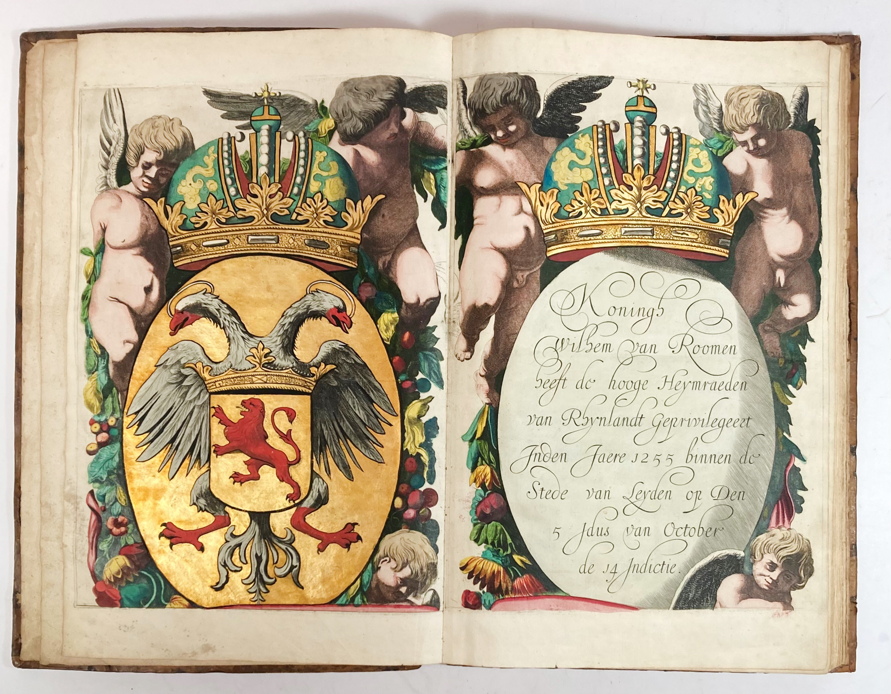
POLDER MAPS -- RIJNLAND -- (DOU, J.J. & S. v. BROECKHUYSEN). 't Hoogheymraedschap van Rhynland. (...) vernieut, geämplieert en gecorrigeert (...). (N.pl.), 1687. W. 12 maps on double-p. leaves (= tog. 174 x 168 cm), and the etched border by R. De Hooghe, which was added to this 2nd edition, consisting of 3 double-p. & 8 single-p. leaves with the coats of arms of the dike-reeves, and 2 engr. cartouches w. the patent of the "Staten", all superbly coloured and partly heightened in gold. Lge-fol. Cont. mottled cf., spine raised in bands w. gold dec., sides elegantly dec. in gold, bound in all probability by the Necklace Bindery at Leiden (active between 1735 and 1795). (Spine ends dam., some wear to sides & extremities, lower corner of backside neatly repaired, some marginal yellowing & foxing, images largely untouched and colours magnificently crisp & bright).
Second edition (first edition 1647) of this magnificent map by Jan Jansz. Dou en Steven van Broeckhuysen which was augmented with borders by Romeyn de Hooghe. When all leaves are fit together this superb map measures 215 x 243 cm. "Hun (Dou & Broeckhuysen) grote kaart uit 1647, de opvolger van Floris Balthasar's kaart, geldt terecht als het "non plus ultra" van Nederlands waterschapskartering uit de 17e eeuw. (...) De grote schaal (1:30.000) veroorloofde de volledige weergave van de bewoning: niet alleen de buitenplaatsen maar alle boerderijen en overige opstallen langs de wegen. Onvervangbare informatie over de infrastructuur van het dichtst bewoonde gedeelte van Nederland in de Gouden Eeuw." - Renkema 202.2; Koeman, Geschied. v.d. kartografie van Nederland, p. 138. Donkersloot-de Vrij 715; Landwehr, RdH, p. 277; Storm van Leeuwen part IIA, p. 260ff.€ 4000
Terug