Kavel 910
910
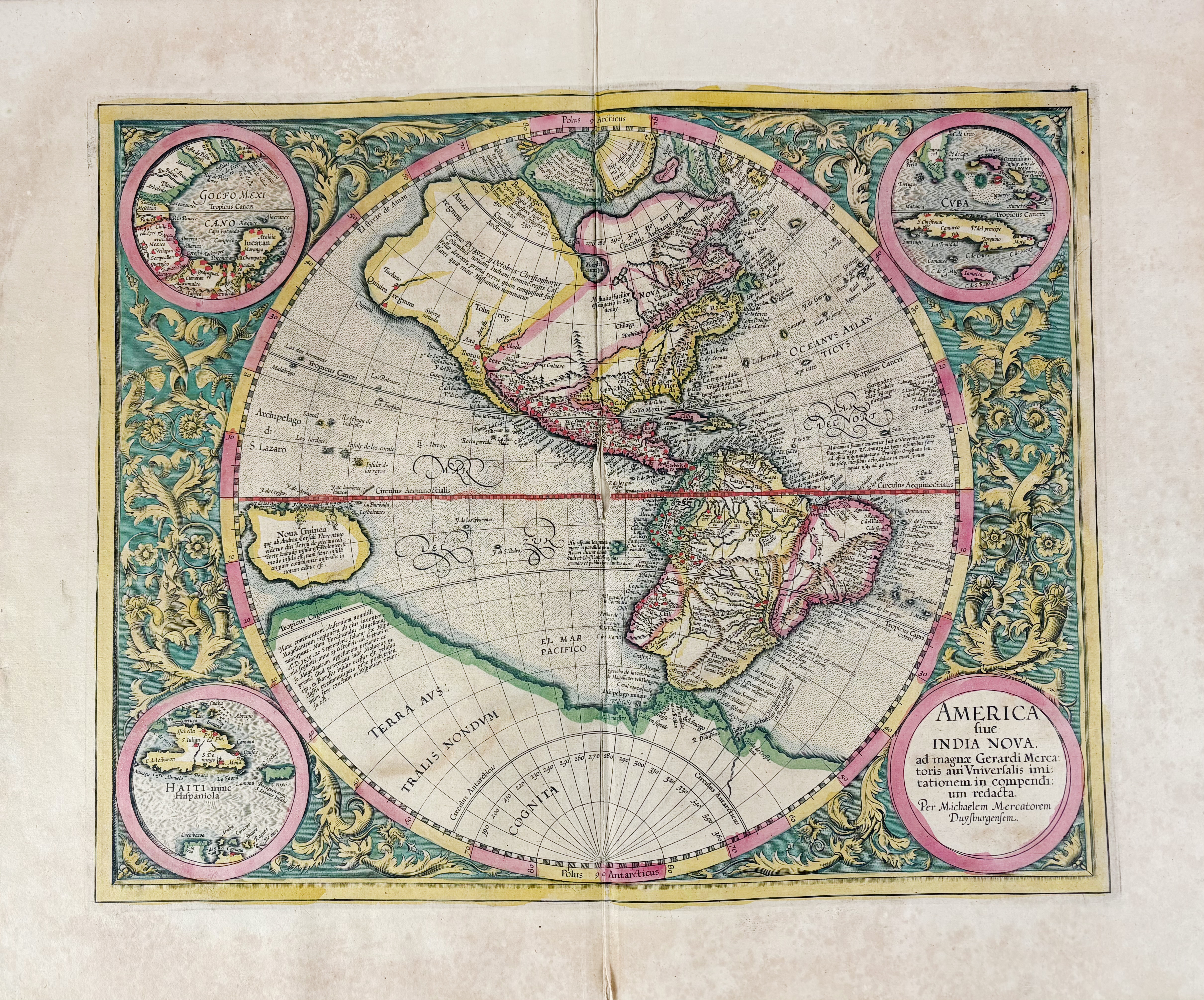
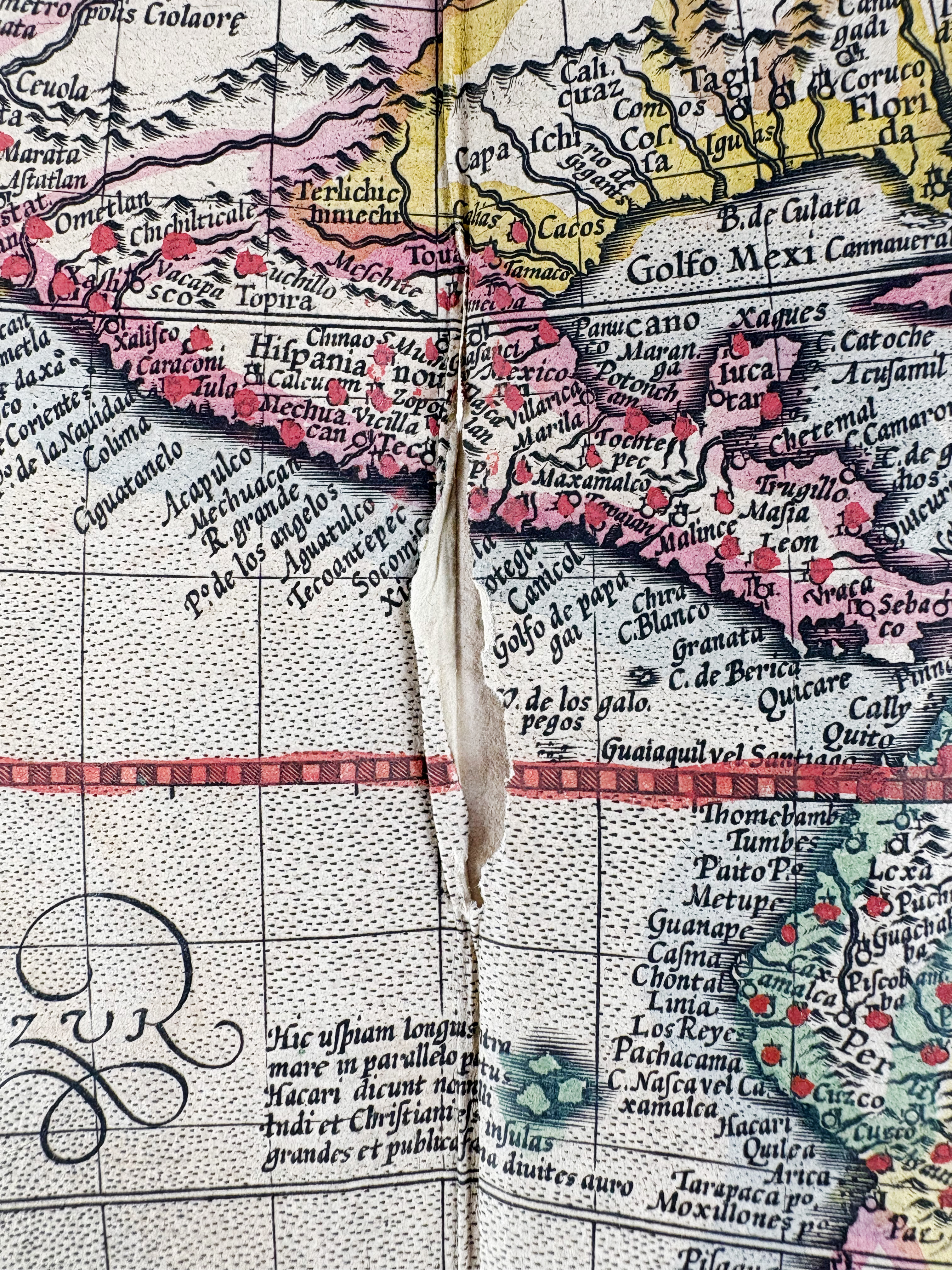
AMERICA -- "AMERICA SIVE INDIA NOVA". (Duisburg, Mercator Heirs, 1609 (or 1619?)). Engr. circular map of the western hemisphere in beautiful handcolouring, surrounded by 3 inset circular maps of Cuba, Haiti and the Gulf of Mexico in each corner, the title set in the fourth. 377 x 470 mm. (Split in the centre (in need of repair, but without loss of image), a bit browned).
The only printed map known by Michael Mercator, grandson of Gerard. Burden 87: "A few of the most famous theories are still present: a large inland lake in Canada, two of the four islands of the North Pole, a bulge to the west coast of South America and the large southern continent. It does not show any knowledge of the English in Virginia, which is possibly a reflection of their failure by then. A large St. Lawrence River is shown originating half way across the continent (…)"; V.d. Krogt I, 9000:1A.€ 1800
uitslag € 0
Terug